
IMAGES TAKEN NEAR TO
Ridley Avenue, BLYTH, NE24 3BB
Introduction
This page details the photographs taken nearby to Ridley Avenue, NE24 3BB by members of the Geograph project.
The Geograph project started in 2005 with the aim of publishing, organising and preserving representative images for every square kilometre of Great Britain, Ireland and the Isle of Man.

There are currently over 7.5m images from over14,400 individuals and you can help contribute to the project by visiting https://www.geograph.org.uk
Image Map
Images are licensed for reuse under creativecommons.org/licenses/by-sa/2.0
Notes
- Clicking on the map will re-center to the selected point.
- The higher the marker number, the further away the image location is from the centre of the postcode.
Image Listing (143 Images Found)
Images are licensed for reuse under creativecommons.org/licenses/by-sa/2.0
Image
Details
Distance
2
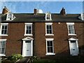
8 & 9 Bath Terrace, Blyth
These two brick built properties form part of a 1790-built terrace (5-10 Bath Terrace) in which all properties are Grade II Listed. The historic High Light, which can just be seen protruding above the roof line, is attached to the rear wing of number 8 Bath Terrace.
Image: © Geoff Holland
Taken: 22 Dec 2020
0.05 miles
4
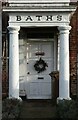
Whitewashed Stone Porch, 11 Bath Terrace, Blyth
This Grade II Listed property was originally built as a house in the last decade of the 18th century, and was subsequently altered to a bath-house, in the early part of the 19th century. When the property was built the street appears to have been called Bath Row. It is now a private residence.
Image: © Geoff Holland
Taken: 22 Dec 2020
0.05 miles
5
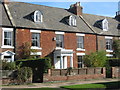
Baths, a residence in Blyth
Situated in Bath Terrace Blyth Northumberland.
Image: © Peter Robinson
Taken: 7 Oct 2009
0.05 miles
6
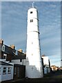
High Light, Back Bath Terrace, Blyth
This lighthouse, which is Grade II Listed, was built between 1780-90 and was subsequently heightened twice in the latter part of the 19th century and the early part of the 20th century. The lighthouse was operated in conjunction with the Low Light until 1985, when it was superseded by modern navigation aids on a different alignment.
Image: © Geoff Holland
Taken: 22 Dec 2020
0.06 miles
7
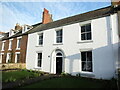
13 Bath Terrace, Blyth
This rendered and whitewashed terraced property, which is Grade II Listed, was built in the early part of the 19th century at which time the street appears to have been named Bath Row.
Image: © Geoff Holland
Taken: 22 Dec 2020
0.06 miles
8
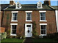
12 Bath Terrace, Blyth
This fine brick-built terraced property, which is Grade II Listed, was built in about 1800 at which time the street appears to have been named Bath Row.
Image: © Geoff Holland
Taken: 22 Dec 2020
0.06 miles
9
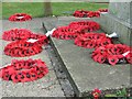
Poppies
Placed at the war memorials for the Boer War and WW1, Ridley Park, Blyth
Image: © Christine Westerback
Taken: 24 Feb 2008
0.06 miles
10
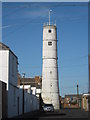
The High Light Blyth Northumberland
A disused lighthouse at the rear of Bath Terrace, situated away from the shoreline and last used in 1985
Image: © Peter Robinson
Taken: 7 Oct 2009
0.06 miles