
IMAGES TAKEN NEAR TO
Alexandra Way, CRAMLINGTON, NE23 6ED
Introduction
This page details the photographs taken nearby to Alexandra Way, NE23 6ED by members of the Geograph project.
The Geograph project started in 2005 with the aim of publishing, organising and preserving representative images for every square kilometre of Great Britain, Ireland and the Isle of Man.

There are currently over 7.5m images from over14,400 individuals and you can help contribute to the project by visiting https://www.geograph.org.uk
Image Map
Images are licensed for reuse under creativecommons.org/licenses/by-sa/2.0
Notes
- Clicking on the map will re-center to the selected point.
- The higher the marker number, the further away the image location is from the centre of the postcode.
Image Listing (9 Images Found)
Images are licensed for reuse under creativecommons.org/licenses/by-sa/2.0
Image
Details
Distance
1
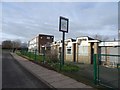
Ready, Set, Grow
A nursery situated in what was once a pub, The Hind. Cramlington. The road is a cyclepath.
Image: © Richard Webb
Taken: 26 Jan 2019
0.09 miles
2
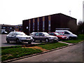
Doxford Place Methodist Church
Utilitarian Church building in the middle of one of the Cramlington estates. Standing on cycle path next to the church.
Image: © Carol Davenport
Taken: 12 Apr 2007
0.11 miles
3
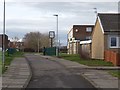
Cycleway, Cramlington
A road dedicated to bikes and mobility scooters etc. Typical new town planning. The nursery has a pub sign, the building is a former pub, The Hind.
Image: © Richard Webb
Taken: 26 Jan 2019
0.13 miles
4
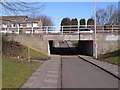
Cycleway underpass under Northumbrian Road
There are a number of cycleways built into the fabric of the new town of Cramlington.
Image: © Oliver Dixon
Taken: 2 Mar 2010
0.14 miles
5
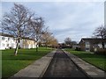
Cycleway, Cramlington
New Town planning between Allerhope and Anton Place, a rare example of a road dedicated to non motorised transport.
Image: © Richard Webb
Taken: 26 Jan 2019
0.15 miles
6
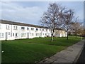
Houses, Allerhope, Cramlington
Motor access is on the other side, the road here is for bikes - very civilised.
Image: © Richard Webb
Taken: 26 Jan 2019
0.17 miles
7
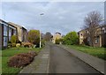
Cycleway, Cramlington
Heading for Seven Oaks Park and the Town Centre.
Image: © Richard Webb
Taken: 26 Jan 2019
0.17 miles
9
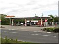
Sainsbury's petrol station, Cramlington
The fuel filling station is located some distance from the main supermarket which is on the northern side of the Manor Walks shopping centre, whilst the garage is on the southern side of the centre.
Image: © Graham Robson
Taken: 15 May 2016
0.24 miles