
IMAGES TAKEN NEAR TO
Kirkwhelpington, NEWCASTLE UPON TYNE, NE19 2RT
Introduction
This page details the photographs taken nearby to NE19 2RT by members of the Geograph project.
The Geograph project started in 2005 with the aim of publishing, organising and preserving representative images for every square kilometre of Great Britain, Ireland and the Isle of Man.

There are currently over 7.5m images from over14,400 individuals and you can help contribute to the project by visiting https://www.geograph.org.uk
Image Map
Images are licensed for reuse under creativecommons.org/licenses/by-sa/2.0
Notes
- Clicking on the map will re-center to the selected point.
- The higher the marker number, the further away the image location is from the centre of the postcode.
Image Listing (37 Images Found)
Images are licensed for reuse under creativecommons.org/licenses/by-sa/2.0
Image
Details
Distance
1

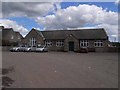
Village Hall and Coal Deliveries
Coal not for the Village Hall since there aren't any chimneys.
The Village hall also houses the Post Office.
Image: © Les Hull
Taken: 8 Mar 2023
0.02 miles
3
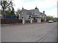
Former school, Kirkwhelpington
The village school was built in 1858 but closed in 1972.
Image: © Oliver Dixon
Taken: 26 Apr 2009
0.02 miles
4
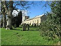
St Bartholomew's Church, Kirkwhelpington
St Bartholomew's church was built in the 13th century, but has been altered since, mainly in the 15th and 19th centuries. It is the parish church of Kirkwhelpington. St Bartholomew's church is a Grade II* Listed Building protected by law.
https://keystothepast.info/search-records/results-of-search/results-of-search-2/site-details/?PRN=N9575
Image: © Les Hull
Taken: 8 Mar 2023
0.03 miles
5

The grave of Sir Charles Algernon Parsons and his wife Katharine
Sir Charles Algernon Parsons designed the modern steam turbine in 1884. See https://research.ncl.ac.uk/northerninnovation/exhibits/charlesparsons/ for further information.
The graves are located in the churchyard of St Bartholomew's, Kirkwhelpington.
Image: © James T M Towill
Taken: 13 Jun 2025
0.03 miles
6
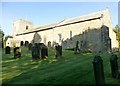
The Church Of St. Bartholomew
The Church of St. Bartholomew was built in the thirteenth-century. Its low, broad perpendicular tower and long nave and chancel, was altered in the fifteenth century and again in 1896. Excavations have revealed that the building originally had aisles and transepts. There are two fourteenth-century bells, a seventeenth-century font (which rests on the reversed capital of a fourteenth or fifteenth-century pier) and a mahogany pulpit from 1797. The glass includes work by Heaton, Butler and Bayne (1909 and 1914).
Image: © Rude Health
Taken: 30 Sep 2015
0.04 miles
7
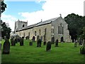
St Bartholomew's Church, Kirkwhelpington
Kirkwhelpington is a village just off the A696 south-east of Otterburn.
St Bartholomew's Church dates mainly from the 13th century with alterations in the 15th century and restoration in 1897. It has a long nave with a low, broad square tower. The church is a Grade II* listed building.
Image: © G Laird
Taken: 16 Aug 2018
0.04 miles
8
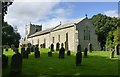
St Bartholomew's Church, Kirkwhelpington
The parish church in the charming village of Kirkwhelpington.
Image: © Russel Wills
Taken: 12 Sep 2017
0.04 miles
9
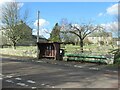
Bus Stop and Long Bench Seat
Does this indicate a very long bus queue?
Image: © Les Hull
Taken: 8 Mar 2023
0.04 miles
10
Kirkwhelpington
Bus stop in Kirkwhelpington.
Image: © Richard Webb
Taken: 8 Jun 2016
0.04 miles