St Bartholomew's Church, Kirkwhelpington
Introduction
The photograph on this page of St Bartholomew's Church, Kirkwhelpington by G Laird as part of the Geograph project.
The Geograph project started in 2005 with the aim of publishing, organising and preserving representative images for every square kilometre of Great Britain, Ireland and the Isle of Man.

There are currently over 7.5m images from over 14,400 individuals and you can help contribute to the project by visiting https://www.geograph.org.uk
St Bartholomew's Church, Kirkwhelpington
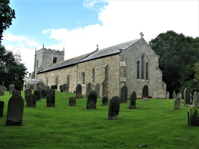
Image: © G Laird Taken: 16 Aug 2018
Kirkwhelpington is a village just off the A696 south-east of Otterburn. St Bartholomew's Church dates mainly from the 13th century with alterations in the 15th century and restoration in 1897. It has a long nave with a low, broad square tower. The church is a Grade II* listed building.
Images are licensed for reuse under creativecommons.org/licenses/by-sa/2.0
Image Location


Leaflet Map data © OpenStreetMap
Latitude
55.154024
Longitude
-2.007032