
IMAGES TAKEN NEAR TO
Pilgrim Street, NEWCASTLE UPON TYNE, NE1 6BL
Introduction
This page details the photographs taken nearby to Pilgrim Street, NE1 6BL by members of the Geograph project.
The Geograph project started in 2005 with the aim of publishing, organising and preserving representative images for every square kilometre of Great Britain, Ireland and the Isle of Man.

There are currently over 7.5m images from over14,400 individuals and you can help contribute to the project by visiting https://www.geograph.org.uk
Image Map
Images are licensed for reuse under creativecommons.org/licenses/by-sa/2.0
Notes
- Clicking on the map will re-center to the selected point.
- The higher the marker number, the further away the image location is from the centre of the postcode.
Image Listing (2119 Images Found)
Images are licensed for reuse under creativecommons.org/licenses/by-sa/2.0
Image
Details
Distance
1
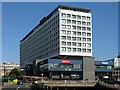
55? North, Pilgrim Street, NE1 (2)
See also Image Further details of the building's history, including many old photographs, are at https://fiftyfivedegrees.files.wordpress.com/2013/09/55-degrees-northfinal.pdf . The main block is now residential https://55degsnorth.co.uk/ while the lower levels include a restaurant and Metro Radio https://onlineradiobox.com/uk/metroradio/ . Another of Newcastle’s Masterpieces of Modern Architecture https://www.geograph.org.uk/search.php?i=109769006&page=1 .
Image: © Mike Quinn
Taken: 21 Sep 2019
0.01 miles
2
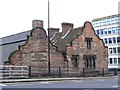
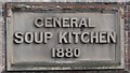
(The former) Holy Jesus Hospital, City Road, NE1 - west end
See Image Shows the location of Image The ground and first floors of the buildings are below the road level.
Image: © Mike Quinn
Taken: 16 Dec 2014
0.01 miles
3
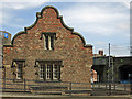
(The former) Holy Jesus Hospital, City Road, NE1 - west end
Image: © Mike Quinn
Taken: 5 Jun 2018
0.01 miles
4
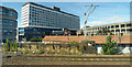
55 Degrees North
Luxury living in the heart of Newcastle https://55degsnorth.co.uk/ . Viewed from a north bound train.
Image: © Thomas Nugent
Taken: 29 Aug 2016
0.02 miles
6
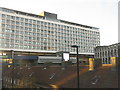
Swan House, Newcastle upon Tyne
A 1960s office block astride a motorway [A167(M)], now known as 55 degrees and also housing Your Metro Radio HQ, a bar, offices and flats. As a location name '55 degrees' [north implied] it is rather inaccurate and misleading - the 55 degree line of latitude is 3.14km further north [as measured on Google Earth].
The red roofs below belong to the Holy Jesus Hospital Image
Image: © M J Richardson
Taken: 18 Nov 2019
0.02 miles
7
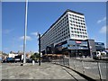
55 Degrees North
This is the former Swan House, built in the 1960's and widely derided as a concrete monstrosity. It sits at the bottom of Pilgrim Street in Newcastle's city centre and is a prominent sight to traffic coming over the Tyne Bridge. The area is in the middle of redevelopment, after which it may seem a little less conspicuous.
Image: © Robert Graham
Taken: 28 Jun 2019
0.02 miles
8
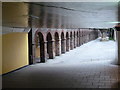
Newcastle upon Tyne: a subway and an older wall
Looking through one of the subways into daylight, the modern facility contrasting sharply with the lower floor of a much older building.
I have not been able to ascertain for certain that this is the correct location so I'd be grateful if anyone could confirm or correct!
Image: © Chris Downer
Taken: 7 Aug 2011
0.02 miles
9
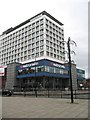
Metro Radio
Office block perched above a motorway.
Image: © Richard Webb
Taken: 7 Mar 2009
0.02 miles
10
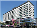
Swan House, Pilgrim Street, Newcastle (2)
A 1960s effort which stands out, its regular, clean grid making for satisfying elevations. By Robert Matthew, Johnson-Marshall & Partners, 1963-69.
It is now known as 55° North, containing a bar, offices, flats, and a local radio station, Metro Radio.
Image: © Stephen Richards
Taken: 14 Aug 2012
0.02 miles