Swan House, Newcastle upon Tyne
Introduction
The photograph on this page of Swan House, Newcastle upon Tyne by M J Richardson as part of the Geograph project.
The Geograph project started in 2005 with the aim of publishing, organising and preserving representative images for every square kilometre of Great Britain, Ireland and the Isle of Man.

There are currently over 7.5m images from over 14,400 individuals and you can help contribute to the project by visiting https://www.geograph.org.uk
Swan House, Newcastle upon Tyne
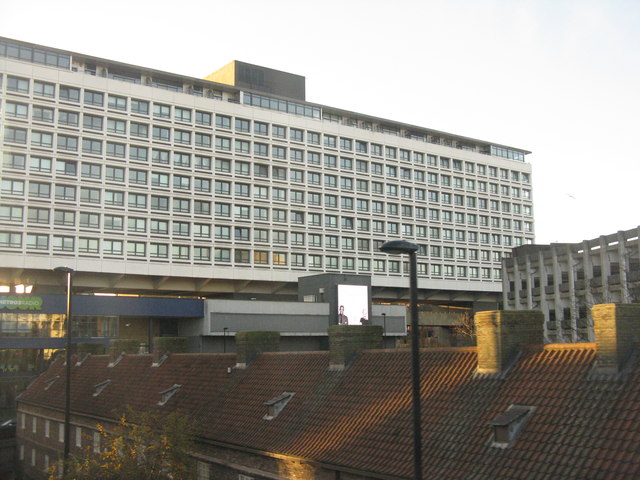
Image: © M J Richardson Taken: 18 Nov 2019
A 1960s office block astride a motorway [A167(M)], now known as 55 degrees and also housing Your Metro Radio HQ, a bar, offices and flats. As a location name '55 degrees' [north implied] it is rather inaccurate and misleading - the 55 degree line of latitude is 3.14km further north [as measured on Google Earth]. The red roofs below belong to the Holy Jesus Hospital Image
Images are licensed for reuse under creativecommons.org/licenses/by-sa/2.0
Image Location


Leaflet Map data © OpenStreetMap
Latitude
54.971607
Longitude
-1.608501