
IMAGES TAKEN NEAR TO
The Sycamores, NEWCASTLE UPON TYNE, NE16 6PH
Introduction
This page details the photographs taken nearby to The Sycamores, NE16 6PH by members of the Geograph project.
The Geograph project started in 2005 with the aim of publishing, organising and preserving representative images for every square kilometre of Great Britain, Ireland and the Isle of Man.

There are currently over 7.5m images from over14,400 individuals and you can help contribute to the project by visiting https://www.geograph.org.uk
Image Map
Images are licensed for reuse under creativecommons.org/licenses/by-sa/2.0
Notes
- Clicking on the map will re-center to the selected point.
- The higher the marker number, the further away the image location is from the centre of the postcode.
Image Listing (5 Images Found)
Images are licensed for reuse under creativecommons.org/licenses/by-sa/2.0
Image
Details
Distance
1
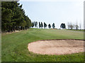
Fairway with sand trap
Part of the Hobson Golf Course which lies to the north of the village of Tanfield.
Image: © Trevor Littlewood
Taken: 18 Apr 2019
0.15 miles
3
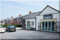
The Joinery at Crookgate Bank
The Joinery is a café on the east side of the A692 at Crookgate Bank which appears to be an ex-council housing estate, adjacent to Burnopfield.
Image: © Trevor Littlewood
Taken: 18 Apr 2019
0.21 miles
5
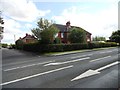
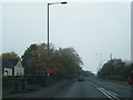
Bowesville, Crookgate
Housing estate in Crookgate, a village near Burnopfield. It gets its name from the former coalowners, the Bowes family.
Image: © Robert Graham
Taken: 8 Aug 2012
0.23 miles