
IMAGES TAKEN NEAR TO
Burnopfield, NEWCASTLE UPON TYNE, NE16 6NS
Introduction
This page details the photographs taken nearby to NE16 6NS by members of the Geograph project.
The Geograph project started in 2005 with the aim of publishing, organising and preserving representative images for every square kilometre of Great Britain, Ireland and the Isle of Man.

There are currently over 7.5m images from over14,400 individuals and you can help contribute to the project by visiting https://www.geograph.org.uk
Image Map
Images are licensed for reuse under creativecommons.org/licenses/by-sa/2.0
Notes
- Clicking on the map will re-center to the selected point.
- The higher the marker number, the further away the image location is from the centre of the postcode.
Image Listing (16 Images Found)
Images are licensed for reuse under creativecommons.org/licenses/by-sa/2.0
Image
Details
Distance
3
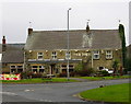
The Pack Horse, Crookgate
Just outside Burnopfield, this pub was destroyed by fire in 2002 but reopened after six months
Image: © Alan Fearon
Taken: 6 Feb 2006
0.04 miles

5
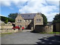
Danmick House
Elegant house dated 2007 beside the A692, Lobley Hill Road.
Image: © Oliver Dixon
Taken: 29 Jul 2020
0.05 miles
8
Crookbank Farm from the north
This farm stands on a ridge above the A692, the main road from Gateshead to Consett. It has a lot of old buildings, probably early C19 in origin.
Image: © Robert Graham
Taken: 4 Jul 2014
0.10 miles
10
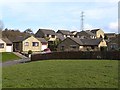
Oakfield, Burnopfield
Modern housing estate on the steep southern side of the Derwent valley.
Image: © Oliver Dixon
Taken: 28 Feb 2014
0.11 miles