
IMAGES TAKEN NEAR TO
Hobson Industrial Estate, NEWCASTLE UPON TYNE, NE16 6EA
Introduction
This page details the photographs taken nearby to Hobson Industrial Estate, NE16 6EA by members of the Geograph project.
The Geograph project started in 2005 with the aim of publishing, organising and preserving representative images for every square kilometre of Great Britain, Ireland and the Isle of Man.

There are currently over 7.5m images from over14,400 individuals and you can help contribute to the project by visiting https://www.geograph.org.uk
Image Map
Images are licensed for reuse under creativecommons.org/licenses/by-sa/2.0
Notes
- Clicking on the map will re-center to the selected point.
- The higher the marker number, the further away the image location is from the centre of the postcode.
Image Listing (5 Images Found)
Images are licensed for reuse under creativecommons.org/licenses/by-sa/2.0
Image
Details
Distance
1
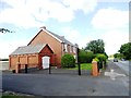
Former colliery house at the Hobson
I think this may have been the colliery managers house for the Hobson pit. Virtually everything else has long gone.
Image: © Robert Graham
Taken: 8 Aug 2012
0.13 miles
2
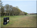
The twelfth, at Hobson Golf Course
The 'tee', and fairway at the Hobson Golf Course close to Burnopfield. The A692 runs alongside the line of trees heading towards Gateshead.
Image: © Trevor Littlewood
Taken: 18 Apr 2019
0.19 miles
4
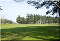
Across Hobson Golf Course
The neatly clipped grasslands of the golf course as seen from one of several public rights of way crossing the land.
Image: © Trevor Littlewood
Taken: 18 Apr 2019
0.24 miles
5
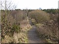
Foot- and cycle-path at Burnopfield
This path forms part of Regional Route 11 of the National Cycle Network, which for the most part follows the trackbed of the old Bowes Railway.
Over this section it appears to have diverged from the line of the railway and runs through woodland above Burnopfield.
Image: © Oliver Dixon
Taken: 28 Feb 2014
0.25 miles