
IMAGES TAKEN NEAR TO
Burnopfield, NEWCASTLE UPON TYNE, NE16 6AR
Introduction
This page details the photographs taken nearby to NE16 6AR by members of the Geograph project.
The Geograph project started in 2005 with the aim of publishing, organising and preserving representative images for every square kilometre of Great Britain, Ireland and the Isle of Man.

There are currently over 7.5m images from over14,400 individuals and you can help contribute to the project by visiting https://www.geograph.org.uk
Image Map
Images are licensed for reuse under creativecommons.org/licenses/by-sa/2.0
Notes
- Clicking on the map will re-center to the selected point.
- The higher the marker number, the further away the image location is from the centre of the postcode.
Image Listing (32 Images Found)
Images are licensed for reuse under creativecommons.org/licenses/by-sa/2.0
Image
Details
Distance
1

View of Low Ewehurst
View of this old farmstead from the north. Behind the farm can be seen the TV mast on Pontop Pike, hundreds of feet higher up.
Image: © Robert Graham
Taken: 26 Mar 2014
0.01 miles
2

Low Ewehurst farm
This lovely old farm is deep in the woods on the southern slopes of the Derwent Valley. It is a linear style farm and so perhaps dates back to the 18th century.
Image: © Robert Graham
Taken: 26 Mar 2014
0.02 miles
3

Low Ewehurst
The farm at Low Ewehurst seen from the north along a path at the edge of a field. A new hedge has been planted at the top of a steep bank descending into a wooded valley at the left side of the image.
Image: © Trevor Littlewood
Taken: 15 Sep 2022
0.02 miles
4

Gate into the woods
Path into Pontburn Woods near Low Ewehurst.
Image: © Robert Graham
Taken: 1 Nov 2017
0.07 miles
5

Field near Low Ewehurst
The path to the right turns a right angle to follow the transverse fence.
Image: © Oliver Dixon
Taken: 27 Jan 2022
0.10 miles
6

Sunken lane in the woods
An old footpath in Collierley Wood near Hamsterley Hall. It may have once been a waggonway from the days when coal was mined in this area.
Image: © Robert Graham
Taken: 11 Apr 2022
0.10 miles
7

Sunken lane in the woods
One of many old paths through Pontburn Woods. A lot of them will date back to the days of coal mining in the 18th and 19th centuries. Small scale drift mines were worked in the area.
Image: © Robert Graham
Taken: 2 Mar 2020
0.11 miles
8
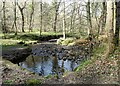
Footbridge over the Pont Burn
A footbridge over the burn in the woods near Hamsterley.
Image: © Robert Graham
Taken: 11 Apr 2022
0.12 miles
9

Fields above Low Ewehurst
Old Papermill Cottage amongst the trees.
Image: © Oliver Dixon
Taken: 27 Jan 2022
0.13 miles
10

Culvert for the Pont Burn
Carrying the stream under the path through the woods.
Image: © Robert Graham
Taken: 11 Apr 2022
0.14 miles