IMAGES TAKEN NEAR TO
Southfield Green, NEWCASTLE UPON TYNE, NE16 4RL
Introduction
This page details the photographs taken nearby to Southfield Green, NE16 4RL by members of the Geograph project.
The Geograph project started in 2005 with the aim of publishing, organising and preserving representative images for every square kilometre of Great Britain, Ireland and the Isle of Man.

There are currently over 7.5m images from over14,400 individuals and you can help contribute to the project by visiting https://www.geograph.org.uk
Image Map
Images are licensed for reuse under creativecommons.org/licenses/by-sa/2.0
Notes
- Clicking on the map will re-center to the selected point.
- The higher the marker number, the further away the image location is from the centre of the postcode.
Image Listing (12 Images Found)
Images are licensed for reuse under creativecommons.org/licenses/by-sa/2.0
Image
Details
Distance
1
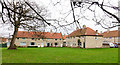
Houses of Broadpool Terrace
Broadpool Terrace lies to the east of Broom Lane across an area of grass; it's in the Whickham district of Gateshead.
Image: © Trevor Littlewood
Taken: 30 Jan 2020
0.10 miles
2
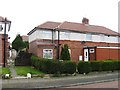
68 The Drive, Whickham
My grandparents old house
Image: © Alex McGregor
Taken: 20 Apr 2014
0.13 miles
3
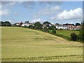
Urban/rural fringe at Whickham
Field of wheat and meadow at Washingwells Farm abut onto the housing on Broom Lane.
Image: © Oliver Dixon
Taken: 24 Jul 2019
0.17 miles
4
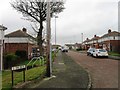
The Drive, Whickham
Formerly Lenin Drive
Image: © Alex McGregor
Taken: 20 Apr 2014
0.17 miles
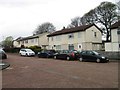
6
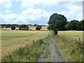
Byway to Buck's Hill
The byway leads between fields of wheat. Marshall Lands Farm can be seen in the distance.
Image: © Oliver Dixon
Taken: 24 Jul 2019
0.19 miles
7
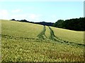
Tractor tracks
In a field of wheat at Washingwells Farm.
Image: © Oliver Dixon
Taken: 24 Jul 2019
0.19 miles
8
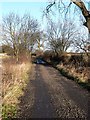
Washingwells Lane
Leading to Watergate Forest Park, Whickham
Image: © Chris Tweedy
Taken: 20 Jan 2006
0.20 miles