IMAGES TAKEN NEAR TO
Monkridge, NEWCASTLE UPON TYNE, NE15 9XH
Introduction
This page details the photographs taken nearby to Monkridge, NE15 9XH by members of the Geograph project.
The Geograph project started in 2005 with the aim of publishing, organising and preserving representative images for every square kilometre of Great Britain, Ireland and the Isle of Man.

There are currently over 7.5m images from over14,400 individuals and you can help contribute to the project by visiting https://www.geograph.org.uk
Image Map (Loading...)


Getting Data...Please wait
Leaflet Map data © OpenStreetMap
Images are licensed for reuse under creativecommons.org/licenses/by-sa/2.0
Notes
- Clicking on the map will re-center to the selected point.
- The higher the marker number, the further away the image location is from the centre of the postcode.
Image Listing (17 Images Found)
Images are licensed for reuse under creativecommons.org/licenses/by-sa/2.0
Image
Details
Distance
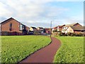
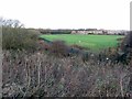
3
Parkland west of North Walbottle Waggonway
Image: © Andrew Curtis
Taken: 1 Dec 2013
0.06 miles
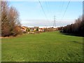
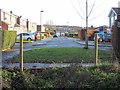
5
Playing Fields, Knop Law Primary School
Image: © Andrew Curtis
Taken: 1 Dec 2013
0.12 miles
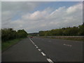
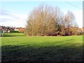
7
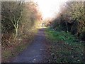
Path along north side of A69
View west towards the waggonway line. The path provides a link across the main A69 dual carriageway via the Blucher subway Image to the North Walbottle Waggonway route on the north side of the road. The former waggonway line was broken by the building of the A69 bypass which can be followed again south of the Hexham Road in Blucher all the way to Lemington.
Image: © Andrew Curtis
Taken: 1 Dec 2013
0.16 miles
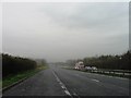
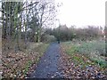
10
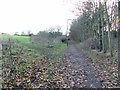
Path along north side of A69
View east towards subway.
Image: © Andrew Curtis
Taken: 1 Dec 2013
0.19 miles