
IMAGES TAKEN NEAR TO
Woodside Avenue, NEWCASTLE UPON TYNE, NE15 9BE
Introduction
This page details the photographs taken nearby to Woodside Avenue, NE15 9BE by members of the Geograph project.
The Geograph project started in 2005 with the aim of publishing, organising and preserving representative images for every square kilometre of Great Britain, Ireland and the Isle of Man.

There are currently over 7.5m images from over14,400 individuals and you can help contribute to the project by visiting https://www.geograph.org.uk
Image Map
Images are licensed for reuse under creativecommons.org/licenses/by-sa/2.0
Notes
- Clicking on the map will re-center to the selected point.
- The higher the marker number, the further away the image location is from the centre of the postcode.
Image Listing (38 Images Found)
Images are licensed for reuse under creativecommons.org/licenses/by-sa/2.0
Image
Details
Distance
1
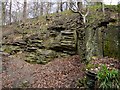
Little Whinstone Dyke, Walbottle Dene
Outcrop of rock named as 'Little Whinstone Dyke' on the 1:25000 OS Map. The niche in the rock is known locally as 'The Devil's Chair'.
Image: © Andrew Curtis
Taken: 3 Apr 2011
0.07 miles
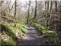
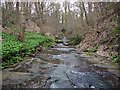
4
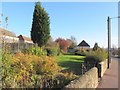
Small park off Newburn Road
The line of the former Throckley Waggonway ran along the boundary at the rear of the houses on Newburn Road (to the right) and those on Mayfield Avenue (on the left). Although not a right of way here, further south-east the line of the waggonway is followed by a rough lane Image
Image: © Andrew Curtis
Taken: 14 Nov 2013
0.11 miles
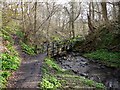
6
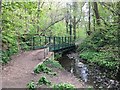
Footbridge over New Burn, Walbottle Dene
Image: © Anthony Foster
Taken: 26 Apr 2020
0.11 miles
8
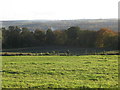
Farmland west of Walbottle
The line of the Vallum south of Hadrian's Wall (underneath the B6528 at this point) is still preserved after almost 2,000 years in the field boundary marked by the fence and gates - see the map and satellite image http://openspace.nearby.org.uk/wheresthepath.htm?lat=54.99417938751807&lon=-1.7441868782043457&gz=17&oz=10>=1.
Image: © Mike Quinn
Taken: 1 Nov 2011
0.13 miles
9
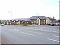
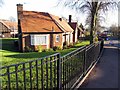
Lindisfarne House, Newburn Road, Throckley
A Care Home and Community Centre built on the site of the Centurion Public House, demolished in 2009. The junction of Broomy Hill Road is on the right.
I wish that I had photographed the pub (built in the 1950s) as I used to pass it every day and never considered it would disappear. The only photo I could find was the sad tale accompanying its demolition http://www.journallive.co.uk/north-east-news/todays-news/2009/02/18/worker-trapped-by-collapsing-chimney-at-centurion-pub-61634-22952736/
Newcastle Libraries recent posted one dated c1960 http://www.flickr.com/photos/newcastlelibraries/4085705878/
Image: © Andrew Curtis
Taken: 23 Jul 2010
0.13 miles
10
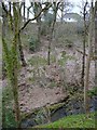
Walbottle Dene
Looking over the steep slopes of the Dene to the backs of the houses on Woodside Avenue.
Image: © Andrew Curtis
Taken: 1 Apr 2011
0.13 miles