IMAGES TAKEN NEAR TO
Claremont Avenue, NEWCASTLE UPON TYNE, NE15 7LD
Introduction
This page details the photographs taken nearby to Claremont Avenue, NE15 7LD by members of the Geograph project.
The Geograph project started in 2005 with the aim of publishing, organising and preserving representative images for every square kilometre of Great Britain, Ireland and the Isle of Man.

There are currently over 7.5m images from over14,400 individuals and you can help contribute to the project by visiting https://www.geograph.org.uk
Image Map (Loading...)


Getting Data...Please wait
Leaflet Map data © OpenStreetMap
Images are licensed for reuse under creativecommons.org/licenses/by-sa/2.0
Notes
- Clicking on the map will re-center to the selected point.
- The higher the marker number, the further away the image location is from the centre of the postcode.
Image Listing (23 Images Found)
Images are licensed for reuse under creativecommons.org/licenses/by-sa/2.0
Image
Details
Distance
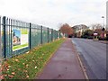
1
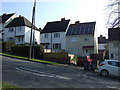
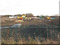
Former Site of Claremont Middle School
Originally Claremont Secondary School.
Then Claremont Middle School
In 1986 it merged with Dumpling Hall Middle School and became Lemington Middle School. Lemington Middle School was a mixed school for 9 - 13 year old pupils which closed on the 31st Aug 2004.
It was used to store books and equipment for the newly constructed Newcastle Library whilst it was being built.
Along with some of my walking companions we taught here in the later 70s and early 80s and a couple in the 90s and into the new century. We all thought it was a great school and enjoyed our time when it was Claremont Middle School.
Demolition of the school
http://newcastlephotos.blogspot.com/2010/05/lemington-middle-school.html
Image: © Les Hull
Taken: 4 Aug 2010
0.15 miles
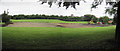
5
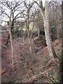
Sugley Dene
The Vallum crossed the Dene here, and continued along the grassy area on the far side (just visible through the undergrowth) - see the satellite image http://wtp2.appspot.com/wheresthepath.htm?lat=54.98436143965019&lon=-1.6987985372543335&gz=18&oz=9>=1.
Image: © Mike Quinn
Taken: 23 Feb 2010
0.18 miles
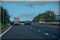
6
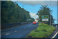
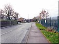
Newburn : A69
The road heads off the A69.
Image: © Lewis Clarke
Taken: 25 Sep 2020
0.20 miles
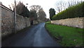
9
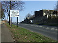
West Denton Road near junction with Union Hall Road
Image: © Andrew Curtis
Taken: 1 Dec 2013
0.21 miles