
IMAGES TAKEN NEAR TO
Quayside, NEWCASTLE UPON TYNE, NE1 3BB
Introduction
This page details the photographs taken nearby to Quayside, NE1 3BB by members of the Geograph project.
The Geograph project started in 2005 with the aim of publishing, organising and preserving representative images for every square kilometre of Great Britain, Ireland and the Isle of Man.

There are currently over 7.5m images from over14,400 individuals and you can help contribute to the project by visiting https://www.geograph.org.uk
Image Map
Images are licensed for reuse under creativecommons.org/licenses/by-sa/2.0
Notes
- Clicking on the map will re-center to the selected point.
- The higher the marker number, the further away the image location is from the centre of the postcode.
Image Listing (627 Images Found)
Images are licensed for reuse under creativecommons.org/licenses/by-sa/2.0
Image
Details
Distance
1
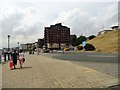
New flats along Newcastle's Quayside
Looking west near the bottom of Sandgate, just downriver from the Millennium Bridge. It can just be seen on the left.
Image: © Robert Graham
Taken: 24 Jul 2013
0.02 miles
2
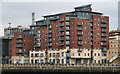
St Ann's Quay
Flats alongside the Tyne on Newcastle Quayside.
Image: © Peter McDermott
Taken: 23 Jan 2011
0.02 miles
3
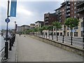
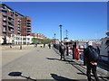
London Wharf
The cycle and footpath along the Tyne passes residential redevelopment opposite the Baltic.
The banners were up for the Olympic Games, a football match was in progress at the time up at St James' Park.
Image: © Richard Webb
Taken: 31 Jul 2012
0.03 miles
6
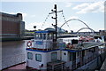
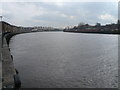
Boats moored by Newcastle Quayside
This is opposite the Baltic Flour Mill which is now an arts centre.
Image: © Bill Boaden
Taken: 20 Apr 2017
0.04 miles
7
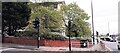
Junction of Crawhall Road and City Road
There is an Ordnance Survey benchmark Image on the brick wall
Image: © Roger Templeman
Taken: 5 May 2022
0.04 miles
8
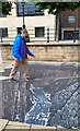
3D street-art, Newcastle Quayside
Crossing a virtual (broken) pipe over a virtual canyon. The street artists, 3D Joe & Max, achieve a striking trompe-l'œil only through the wide angle lens of a smartphone camera.
3D Joe & Max: http://3djoeandmax.com/ https://web.archive.org/web/20210813211529/http://3djoeandmax.com/
Image: © Andrew Curtis
Taken: 9 Aug 2021
0.04 miles
9
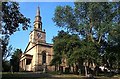
St. Ann's Church, Battlefield, Newcastle upon Tyne
Image: © Bill Henderson
Taken: Unknown
0.04 miles
10

Benchmark on wall of Crawhall Road at junction with City Road
Ordnance Survey documents describe a cut mark benchmark levelled at 21.740m above Newlyn Datum verified 1962 on a works at this location. I wonder if this is the same mark repositioned as the works have been replaced by housing
Image: © Roger Templeman
Taken: 5 May 2022
0.05 miles