Benchmark on wall of Crawhall Road at junction with City Road
Introduction
The photograph on this page of Benchmark on wall of Crawhall Road at junction with City Road by Roger Templeman as part of the Geograph project.
The Geograph project started in 2005 with the aim of publishing, organising and preserving representative images for every square kilometre of Great Britain, Ireland and the Isle of Man.

There are currently over 7.5m images from over 14,400 individuals and you can help contribute to the project by visiting https://www.geograph.org.uk
Benchmark on wall of Crawhall Road at junction with City Road
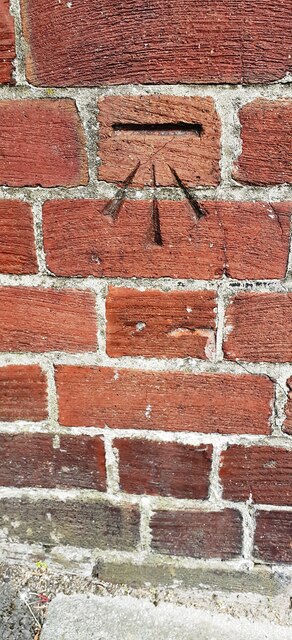
Image: © Roger Templeman Taken: 5 May 2022
Ordnance Survey documents describe a cut mark benchmark levelled at 21.740m above Newlyn Datum verified 1962 on a works at this location. I wonder if this is the same mark repositioned as the works have been replaced by housing
Images are licensed for reuse under creativecommons.org/licenses/by-sa/2.0
Image Location
Latitude
54.972062
Longitude
-1.59639