
IMAGES TAKEN NEAR TO
Peel Court, NEWCASTLE UPON TYNE, NE13 6EA
Introduction
This page details the photographs taken nearby to Peel Court, NE13 6EA by members of the Geograph project.
The Geograph project started in 2005 with the aim of publishing, organising and preserving representative images for every square kilometre of Great Britain, Ireland and the Isle of Man.

There are currently over 7.5m images from over14,400 individuals and you can help contribute to the project by visiting https://www.geograph.org.uk
Image Map
Images are licensed for reuse under creativecommons.org/licenses/by-sa/2.0
Notes
- Clicking on the map will re-center to the selected point.
- The higher the marker number, the further away the image location is from the centre of the postcode.
Image Listing (24 Images Found)
Images are licensed for reuse under creativecommons.org/licenses/by-sa/2.0
Image
Details
Distance
1
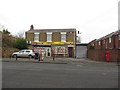
Convenience store and Post Office, Seaton Burn
A convenience store in Seaton Burn which also hosts the village's Post Office branch.
Image: © Graham Robson
Taken: 22 Jan 2017
0.01 miles
2
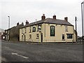
The Moor House pub, Seaton Burn
The Moor House pub is located on the corner of Front Street and Dudley Lane, Seaton Burn.
Image: © Graham Robson
Taken: 22 Jan 2017
0.04 miles
5
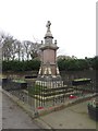
Seaton Burn War Memorial
The War Memorial on Front Street in Seaton Burn which commemorates the village's residents killed in conflict.
Image: © Graham Robson
Taken: 22 Jan 2017
0.11 miles
6
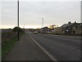
Bridge Street, Seaton Burn
Looking south along Bridge Street in Seaton Burn.
Image: © Graham Robson
Taken: 22 Jan 2017
0.11 miles
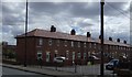
8
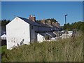
Blagdon Terrace
Surviving colliery rows in Seaton Burn, housing provided by the colliery.
Image: © Richard Webb
Taken: 1 Oct 2015
0.12 miles
9
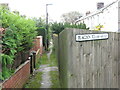
Blagdon Terrace, Seaton Burn
The majority of the rows of dwellings, provided by pit owners for their workers, which once stood here have long since disappeared. However, Blagdon Terrace remains and this very narrow pathway gives access to the dwellings.
Image: © Geoff Holland
Taken: 10 Nov 2020
0.12 miles
10
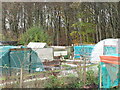
Allotments near Blagdon Terrace, Seaton Burn
Whilst the history of allotments goes back many centuries, it was not until the Small Holdings and Allotments Act 1908 came into force that local authorities were legally obliged to provide "sufficient allotments according to demand". This duty was further extended with the passing of the Land Settlement Facilities Act 1919 with the rights of allotment holders being strengthened by the Allotments Act 1922. However, the most important change was introduced when the Allotments Act 1925 established statutory allotments which local authorities could not sell off or covert to other uses without Ministerial consent. This site is managed by North Tyneside Council.
Image: © Geoff Holland
Taken: 10 Nov 2020
0.14 miles