IMAGES TAKEN NEAR TO
NE12 0GN
Introduction
This page details the photographs taken nearby to NE12 0GN by members of the Geograph project.
The Geograph project started in 2005 with the aim of publishing, organising and preserving representative images for every square kilometre of Great Britain, Ireland and the Isle of Man.

There are currently over 7.5m images from over14,400 individuals and you can help contribute to the project by visiting https://www.geograph.org.uk
Image Map
Images are licensed for reuse under creativecommons.org/licenses/by-sa/2.0
Notes
- Clicking on the map will re-center to the selected point.
- The higher the marker number, the further away the image location is from the centre of the postcode.
Image Listing (12 Images Found)
Images are licensed for reuse under creativecommons.org/licenses/by-sa/2.0
Image
Details
Distance
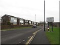
1
Garth Twenty, Killingworth
One of a number of residential streets leading off East Bailey in Killingworth.
Image: © Graham Robson
Taken: 13 Jan 2018
0.08 miles
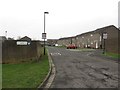
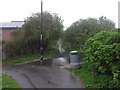
2
East Bailey, Killingworth
The street looping around the residential area to the east of the facilities in the centre of Killingworth.
Image: © Graham Robson
Taken: 13 Jan 2018
0.10 miles
3
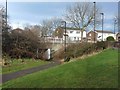
Subway under East Bailey
On a walkway, with status of bridleway, which runs south to north through the eastern end of Killingworth. Possibly on the line of an old waggonway serving Killingworth Old Pit.
Image: © Oliver Dixon
Taken: 23 Feb 2012
0.14 miles
4
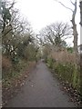
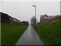
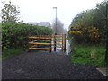
Bridleway, Killingworth
A public bridleway passing between the back gardens of houses and the boundary of a school playing field.
Image: © Graham Robson
Taken: 13 Jan 2018
0.16 miles
5
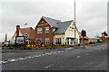
The Shire Horse, Killingworth
A newly constructed (2010) pub/restaurant at the Killingworth Centre.
Image: © David Dixon
Taken: 16 Jun 2012
0.20 miles
6
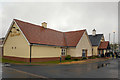
The Shire Horse, Killingworth
A newly constructed (2010) pub/restaurant at the Killingworth Centre.
Image: © David Dixon
Taken: 15 Jun 2012
0.22 miles
7
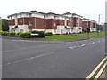
Flats, Citadel East, Killingworth
A modern development of flats in the centre of Killingworth.
Image: © Graham Robson
Taken: 13 Jun 2020
0.22 miles
8
Camperdown summit
At 86m this is the highest point in North Tyneside
Image: © Anthony Foster
Taken: 25 Apr 2014
0.23 miles
9
Camperdown summit
At 86m this is the highest point in North Tyneside
Image: © Anthony Foster
Taken: 25 Apr 2014
0.23 miles