
IMAGES TAKEN NEAR TO
Ashvale Avenue, GATESHEAD, NE11 0XT
Introduction
This page details the photographs taken nearby to Ashvale Avenue, NE11 0XT by members of the Geograph project.
The Geograph project started in 2005 with the aim of publishing, organising and preserving representative images for every square kilometre of Great Britain, Ireland and the Isle of Man.

There are currently over 7.5m images from over14,400 individuals and you can help contribute to the project by visiting https://www.geograph.org.uk
Image Map
Images are licensed for reuse under creativecommons.org/licenses/by-sa/2.0
Notes
- Clicking on the map will re-center to the selected point.
- The higher the marker number, the further away the image location is from the centre of the postcode.
Image Listing (12 Images Found)
Images are licensed for reuse under creativecommons.org/licenses/by-sa/2.0
Image
Details
Distance
2
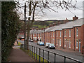
Terraced housing in Kibblesworth
Kibblesworth is a village within the boundaries of Gateshead Metropolitan Borough.
The houses in view are those of Coronation Terrace.
Image: © Trevor Littlewood
Taken: 22 Feb 2012
0.08 miles
4
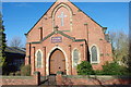
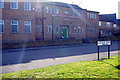
Methodist Church
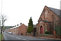
The church is on Kibblesworth village main street.
Image: © peter maddison
Taken: 1 Mar 2011
0.09 miles
6
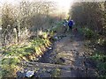
Bowes Railway Path at Kibblesworth
Bowes Railway was originally a colliery railway built to carry coal from the pits at Dipton to the Tyne at Jarrow. The earliest section was designed by George Stephenson and opened on 17 January 1826, making it one of the world's first modern railways. The railway remained virtually intact until 1968. Between 1968 and 1974, most of the line was closed.
The path following the line of the railway has now been designated as Regional Route 11 of the National Cycle Network. The path is also designated as part of the Great North Forest Heritage Trail.
As can be seen here, the path sustained severe storm damage in 2012 and is due to be repaired and upgraded.
Image: © Oliver Dixon
Taken: 8 Jan 2014
0.18 miles
7
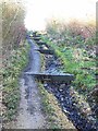
Bowes Railway Path at Kibblesworth
Bowes Railway was originally a colliery railway built to carry coal from the pits at Dipton to the Tyne at Jarrow. The earliest section was designed by George Stephenson and opened on 17 January 1826, making it one of the world's first modern railways. The railway remained virtually intact until 1968. Between 1968 and 1974, most of the line was closed.
The path following the line of the railway has now been designated as Regional Route 11 of the National Cycle Network. The path is also designated as part of the Great North Forest Heritage Trail.
As can be seen here, the path sustained severe storm damage in 2012 and is due to be repaired and upgraded.
Image: © Oliver Dixon
Taken: 8 Jan 2014
0.18 miles
8
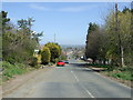
Kibblesworth Bank
Downhill into Kibblesworth.
Image: © JThomas
Taken: 2 May 2013
0.20 miles
9
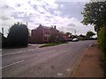
East end of the main street in Kibblesworth
Showing The Plough pub.
Image: © Robert Graham
Taken: 26 Apr 2011
0.22 miles
10
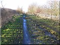
Bowes Railway Path at Kibblesworth
Bowes Railway was originally a colliery railway built to carry coal from the pits at Dipton to the Tyne at Jarrow. The earliest section was designed by George Stephenson and opened on 17 January 1826, making it one of the world's first modern railways. The railway remained virtually intact until 1968. Between 1968 and 1974, most of the line was closed.
The path following the line of the railway has now been designated as Regional Route 11 of the National Cycle Network. The path is also designated as part of the Great North Forest Heritage Trail.
As can be seen here, the path sustained severe storm damage in 2012 and is due to be repaired and upgraded.
Image: © Oliver Dixon
Taken: 8 Jan 2014
0.23 miles