IMAGES TAKEN NEAR TO
Stone Street, GATESHEAD, NE10 9RY
Introduction
This page details the photographs taken nearby to Stone Street, NE10 9RY by members of the Geograph project.
The Geograph project started in 2005 with the aim of publishing, organising and preserving representative images for every square kilometre of Great Britain, Ireland and the Isle of Man.

There are currently over 7.5m images from over14,400 individuals and you can help contribute to the project by visiting https://www.geograph.org.uk
Image Map
Images are licensed for reuse under creativecommons.org/licenses/by-sa/2.0
Notes
- Clicking on the map will re-center to the selected point.
- The higher the marker number, the further away the image location is from the centre of the postcode.
Image Listing (14 Images Found)
Images are licensed for reuse under creativecommons.org/licenses/by-sa/2.0
Image
Details
Distance
1
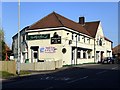
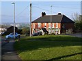
Sutherlands Hotel, Stone Street, Windy Nook
Image: © Andrew Curtis
Taken: 20 May 2012
0.06 miles
3
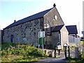
Ebenezer Chapel, Windy Nook
Originally built as a chapel by the Methodist New Connexion in 1865 after their secession in 1797 from the Wesleyan Methodists http://en.wikipedia.org/wiki/Methodist_New_Connexion
The original building is mostly obscured by more recent additions on Stone Street as Windy Nook Methodist Church.
http://www.picturesofgateshead.co.uk/gateshead_churches_methodist/index.html
Image: © Andrew Curtis
Taken: 20 May 2012
0.10 miles
4
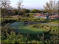
Pond, Windy Nook Nature Park
"The Windy Nook Nature Park project is a partnership between Gateshead Metropolitan Borough Council and the Conservation Volunteers. It began in August 1981. The project is designed to make the land suitable for different species of plant and wild life which would not normally be seen in an urban area. covers about two hectares, and is on land which used to have houses built on it. Many of the people who lived on this site would have worked in the quarry or pit which were only a short distance away."
This account was submitted to the BBC Domesday Project in 1986 http://www.bbc.co.uk/history/domesday/dblock/GB-424000-558000/page/13
The park provides spectacular panoramic views of Tyneside's economic heartland and the east coast beyond.
Image: © Andrew Curtis
Taken: 20 May 2012
0.10 miles
6
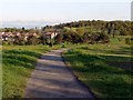
Park on site of former Kell's Quarry, Windy Nook
Richard Kell was the second son of Ebenezer Kell of Felling Shore, born in 1749. Richard began quarrying at Heworth Shore in 1784. The family continued the business of quarrying throughout the C19th, establishing quarries at High Heworth and Windy Nook, amongst others. St. Alban’s Church, Windy Nook Board Schools, the Co-operative Society and Windy Nook Fever Hospital are among the many buildings built with stone from Kell’s Quarry at Windy Nook. Windy Nook Sandstone Quarries were famous for producing high quality grindstones and pulp-stones (used in paper mills). The quarries became run down in the early 1900s and were eventually filled in during the 1960s.
View towards Whitehills, with Image on the hilltop above the trees.
Image: © Andrew Curtis
Taken: 20 May 2012
0.16 miles
7
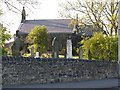
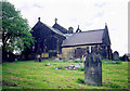
St Alban's Church, Windy Nook
Parish church, 1841-2 by Thomas Liddell, with additions 1888. A Grade II Listed Building http://list.english-heritage.org.uk/resultsingle.aspx?uid=1299810&searchtype=mapsearch
Image: © Andrew Curtis
Taken: 20 May 2012
0.17 miles
8
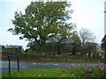
St Alban's Church, Windy Nook
Taken from the car park of the Bay Horse pub across the road. The church is in Windy Nook, on the junctions of Coldwell Lane, Windy Nook Road, Carr Hill Road, Albion Street and Stone Street.
Image: © Steve McShane
Taken: 27 Oct 2005
0.17 miles