IMAGES TAKEN NEAR TO
Piper Close, LONDON, N7 8TY
Introduction
This page details the photographs taken nearby to Piper Close, N7 8TY by members of the Geograph project.
The Geograph project started in 2005 with the aim of publishing, organising and preserving representative images for every square kilometre of Great Britain, Ireland and the Isle of Man.

There are currently over 7.5m images from over14,400 individuals and you can help contribute to the project by visiting https://www.geograph.org.uk
Image Map
Images are licensed for reuse under creativecommons.org/licenses/by-sa/2.0
Notes
- Clicking on the map will re-center to the selected point.
- The higher the marker number, the further away the image location is from the centre of the postcode.
Image Listing (152 Images Found)
Images are licensed for reuse under creativecommons.org/licenses/by-sa/2.0
Image
Details
Distance

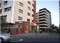
2
Caledonian Road, Lower Holloway
Opposite Caledonian Road Tube Station
Image: © Paul Gillett
Taken: 6 Sep 2014
0.03 miles
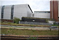
4

Caledonian Road, Lower Holloway
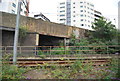
Caledonian Road Underground station, on the Piccadilly Line, is ahead on the left. Beyond that is the bridge over the East Coast Main Line.
Image: © Stephen McKay
Taken: 17 Oct 2007
0.04 miles
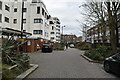
5
Cottage Road, N7
As you can see, I have not made this up.
Image: © Mike Quinn
Taken: 18 Jan 2017
0.04 miles