IMAGES TAKEN NEAR TO
Brecknock Road, LONDON, N7 0BX
Introduction
This page details the photographs taken nearby to Brecknock Road, N7 0BX by members of the Geograph project.
The Geograph project started in 2005 with the aim of publishing, organising and preserving representative images for every square kilometre of Great Britain, Ireland and the Isle of Man.

There are currently over 7.5m images from over14,400 individuals and you can help contribute to the project by visiting https://www.geograph.org.uk
Image Map
Images are licensed for reuse under creativecommons.org/licenses/by-sa/2.0
Notes
- Clicking on the map will re-center to the selected point.
- The higher the marker number, the further away the image location is from the centre of the postcode.
Image Listing (121 Images Found)
Images are licensed for reuse under creativecommons.org/licenses/by-sa/2.0
Image
Details
Distance
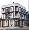
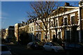
5
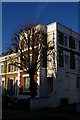
House at junction of Leighton Road and Charlton Kings Road
Image: © Christopher Hilton
Taken: 19 Jan 2017
0.06 miles
6
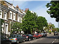
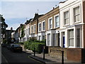
Leighton Road, NW5
East of its junction with Torriano Avenue.
Image: © Mike Quinn
Taken: 12 May 2009
0.06 miles
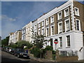
7
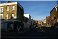
Torriano Avenue from Leighton Road
Image: © Christopher Hilton
Taken: 19 Jan 2017
0.07 miles
9
Leighton Road dropping towards Torriano Avenue
Image: © Christopher Hilton
Taken: 19 Jan 2017
0.08 miles
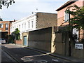
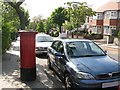
10
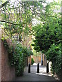
Passage between Torriano Avenue and Leighton Grove, NW5
Image: © Mike Quinn
Taken: 12 May 2009
0.08 miles