IMAGES TAKEN NEAR TO
Highgate Avenue, LONDON, N6 5SJ
Introduction
This page details the photographs taken nearby to Highgate Avenue, N6 5SJ by members of the Geograph project.
The Geograph project started in 2005 with the aim of publishing, organising and preserving representative images for every square kilometre of Great Britain, Ireland and the Isle of Man.

There are currently over 7.5m images from over14,400 individuals and you can help contribute to the project by visiting https://www.geograph.org.uk
Image Map
Images are licensed for reuse under creativecommons.org/licenses/by-sa/2.0
Notes
- Clicking on the map will re-center to the selected point.
- The higher the marker number, the further away the image location is from the centre of the postcode.
Image Listing (228 Images Found)
Images are licensed for reuse under creativecommons.org/licenses/by-sa/2.0
Image
Details
Distance
2

London (Haringey), 1959: southward from Highgate Archway, 1959
View SSE from the Archway on Hornsey Lane (B540), along Archway Road (A1).
Image: © Ben Brooksbank
Taken: 2 Jun 1959
0.08 miles
3
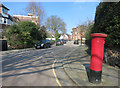
Leaning Letter Box, Southwood Lawn Road
Not my photography for once, this post box is definitely on the skew.
Image: © Des Blenkinsopp
Taken: 17 Mar 2016
0.09 miles
6

Highgate International Church
Until March 2013 known as Cholmeley Evangelical Church.
Image: © Jim Osley
Taken: 23 Jun 2013
0.10 miles
10
View of the Hornsey/Crouch End area from Kingsley Place
Kingsley Place is a very steep side road off Southwood Lane and acts as an excellent vantage point of the Hornsey/Crouch End area at its junction with Southwood Lane. View taken looking east-southeast.
Image: © Robert Lamb
Taken: 27 Jul 2010
0.11 miles