IMAGES TAKEN NEAR TO
Hornsey Lane, LONDON, N6 5LW
Introduction
This page details the photographs taken nearby to Hornsey Lane, N6 5LW by members of the Geograph project.
The Geograph project started in 2005 with the aim of publishing, organising and preserving representative images for every square kilometre of Great Britain, Ireland and the Isle of Man.

There are currently over 7.5m images from over14,400 individuals and you can help contribute to the project by visiting https://www.geograph.org.uk
Image Map
Images are licensed for reuse under creativecommons.org/licenses/by-sa/2.0
Notes
- Clicking on the map will re-center to the selected point.
- The higher the marker number, the further away the image location is from the centre of the postcode.
Image Listing (187 Images Found)
Images are licensed for reuse under creativecommons.org/licenses/by-sa/2.0
Image
Details
Distance
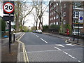
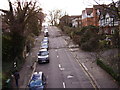
1
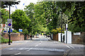
Hornsey Lane
Seen at the junction with Hornsey Lane Gardens, on the left, and Whitehall Park.
Image: © Martin Addison
Taken: 22 May 2009
0.01 miles
3
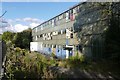
School on Hornsey Lane
This is the old school as it looked in 2015. It has now been demolished and replaced with a new building that houses the Whitehall Park School. It is a "free" school run by BPET the Bellevue Place Education Trust
Image: © Nigel Mykura
Taken: 23 Aug 2015
0.05 miles
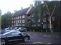
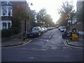
4
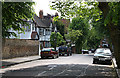
Whitehall Park
A pleasant side street off Hornsey Lane.
Image: © Martin Addison
Taken: 22 May 2009
0.06 miles
5
Stanhope Road
Looking north west showing position of Postbox No. N6 26.
See Image] for postbox.
Image: © JThomas
Taken: 23 Apr 2016
0.06 miles
6
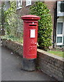
George V postbox on Stanhope Road
Postbox No. N6 26.
See Image] for context.
Image: © JThomas
Taken: 23 Apr 2016
0.06 miles
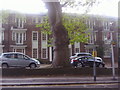
8
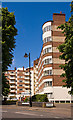
Northwood Hall
A large x shaped block of apartments beside Hornsey Lane.
Image: © Martin Addison
Taken: 22 May 2009
0.09 miles
9
View from Parkland Walk: Looking southeast
Stanhope Road.
Image: © Dr Neil Clifton
Taken: 7 Jan 2012
0.09 miles
10
Gresley Road at the junction of Ashmount Road
Image: © David Howard
Taken: 17 Oct 2013
0.10 miles