IMAGES TAKEN NEAR TO
Woodside Avenue, LONDON, N6 4ST
Introduction
This page details the photographs taken nearby to Woodside Avenue, N6 4ST by members of the Geograph project.
The Geograph project started in 2005 with the aim of publishing, organising and preserving representative images for every square kilometre of Great Britain, Ireland and the Isle of Man.

There are currently over 7.5m images from over14,400 individuals and you can help contribute to the project by visiting https://www.geograph.org.uk
Image Map (Loading...)


Getting Data...Please wait
Leaflet Map data © OpenStreetMap
Images are licensed for reuse under creativecommons.org/licenses/by-sa/2.0
Notes
- Clicking on the map will re-center to the selected point.
- The higher the marker number, the further away the image location is from the centre of the postcode.
Image Listing (108 Images Found)
Images are licensed for reuse under creativecommons.org/licenses/by-sa/2.0
Image
Details
Distance
3
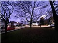
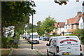
Green on Fordington Road, Highgate
At the junction of Woodside Avenue
Image: © David Howard
Taken: 26 Jan 2022
0.04 miles
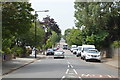
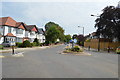
4
Fordington Road at the junction of Woodside Avenue
Image: © David Howard
Taken: 26 Jan 2022
0.04 miles
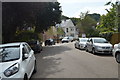
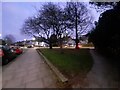
9
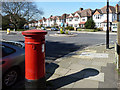
Suburban postbox
Surprisingly, in view of the age of the surroundings, the box is Victorian. Looking at old maps, it was not here in Edwardian times (neither were the houses), so it must have been moved here from somewhere else.
Image: © Robin Webster
Taken: 19 Mar 2011
0.05 miles
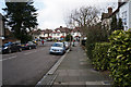
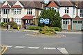
10
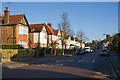
Fordington Road
20mph speed limit in force on this quiet suburban road.
Image: © Martin Addison
Taken: 3 Dec 2008
0.05 miles