IMAGES TAKEN NEAR TO
Old Stable Mews, Mountgrove Road, LONDON, N5 2LR
Introduction
This page details the photographs taken nearby to Old Stable Mews, Mountgrove Road, N5 2LR by members of the Geograph project.
The Geograph project started in 2005 with the aim of publishing, organising and preserving representative images for every square kilometre of Great Britain, Ireland and the Isle of Man.

There are currently over 7.5m images from over14,400 individuals and you can help contribute to the project by visiting https://www.geograph.org.uk
Image Map
Images are licensed for reuse under creativecommons.org/licenses/by-sa/2.0
Notes
- Clicking on the map will re-center to the selected point.
- The higher the marker number, the further away the image location is from the centre of the postcode.
Image Listing (110 Images Found)
Images are licensed for reuse under creativecommons.org/licenses/by-sa/2.0
Image
Details
Distance
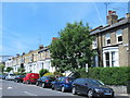
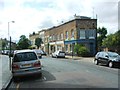
5
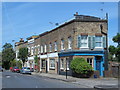
Riversdale Road, N5
See Image Part of the original course of the New River was just to the south of Riversdale Road - it would have been flowing towards the camera position, before entering Clissold Park - see Image
Image: © Mike Quinn
Taken: 18 Jun 2015
0.08 miles
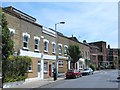
10
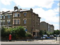
King's Crescent, N4
Shows the location of Image
Image: © Mike Quinn
Taken: 26 Jun 2008
0.10 miles