IMAGES TAKEN NEAR TO
Highbury Grove, LONDON, N5 1HP
Introduction
This page details the photographs taken nearby to Highbury Grove, N5 1HP by members of the Geograph project.
The Geograph project started in 2005 with the aim of publishing, organising and preserving representative images for every square kilometre of Great Britain, Ireland and the Isle of Man.

There are currently over 7.5m images from over14,400 individuals and you can help contribute to the project by visiting https://www.geograph.org.uk
Image Map
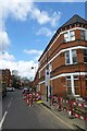
Images are licensed for reuse under creativecommons.org/licenses/by-sa/2.0
Notes
- Clicking on the map will re-center to the selected point.
- The higher the marker number, the further away the image location is from the centre of the postcode.
Image Listing (160 Images Found)
Images are licensed for reuse under creativecommons.org/licenses/by-sa/2.0
Image
Details
Distance
1
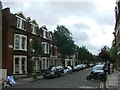
Baalbec Road
Looking along Baalbec Road towards Highbury Fields.
Image: © DS Pugh
Taken: 5 Apr 2016
0.01 miles
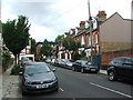
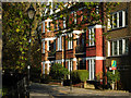
3
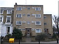
Ashurst Lodge, Islington
Housing block on the junction of Highbury Grove and Baalbec Road (on the right).
Image: © David Anstiss
Taken: 10 Mar 2013
0.02 miles
4
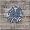
Plaque for Charles Cruft, Islington
On Image
See http://en.wikipedia.org/wiki/Charles_Cruft_(showman) for more details on the dog showman.
Image: © David Anstiss
Taken: 10 Mar 2013
0.02 miles
6
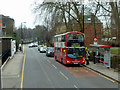
Aberdeen Park bus stop, Highbury Grove
Arriva fleet number DW131 pauses on route 19. Viewed from a route 4 bus.
Image: © Robin Webster
Taken: 29 Jan 2011
0.04 miles
7
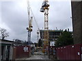
Building Site, Highbury Grove
Along this road, behind No.24 Highbury Grove was the Alexander Centre, block of warehouses and small business spaces.
Instead a development of 72 residential units comprising flats and townhouses will be built instead.
Image: © David Anstiss
Taken: 10 Mar 2013
0.05 miles
9
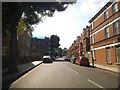
Church Path, Highbury
Church Path extends north of Highbury Place beyond Baalbec Road.
Image: © Stephen McKay
Taken: 26 Nov 2010
0.08 miles
10
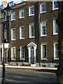
Highbury Place, Highbury
These houses on Highbury Place, overlooking Highbury Fields, date from the 1770s and were amongst the first new buildings that were to transform Highbury from a rural hamlet into a London suburb.
Image: © Stephen McKay
Taken: 26 Nov 2010
0.09 miles