IMAGES TAKEN NEAR TO
Kayani Avenue, LONDON, N4 2GU
Introduction
This page details the photographs taken nearby to Kayani Avenue, N4 2GU by members of the Geograph project.
The Geograph project started in 2005 with the aim of publishing, organising and preserving representative images for every square kilometre of Great Britain, Ireland and the Isle of Man.

There are currently over 7.5m images from over14,400 individuals and you can help contribute to the project by visiting https://www.geograph.org.uk
Image Map
Images are licensed for reuse under creativecommons.org/licenses/by-sa/2.0
Notes
- Clicking on the map will re-center to the selected point.
- The higher the marker number, the further away the image location is from the centre of the postcode.
Image Listing (259 Images Found)
Images are licensed for reuse under creativecommons.org/licenses/by-sa/2.0
Image
Details
Distance
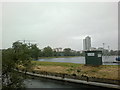
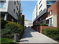
1
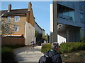
View into Kayani Avenue from the New River Walkway
Looking north-northeast.
Image: © Robert Lamb
Taken: 29 Mar 2014
0.02 miles
2
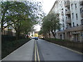
View down Kayani Avenue from Woodberry Down
Looking south-southeast.
Image: © Robert Lamb
Taken: 29 Mar 2014
0.02 miles
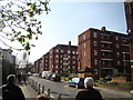
3
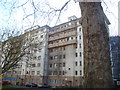
View of Needwood House from Woodberry Down
Quite a stark contrast to the architecture seen so far on the Woodberry Down Estate! Looking south-southeast.
Image: © Robert Lamb
Taken: 29 Mar 2014
0.02 miles
5
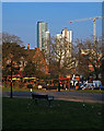
Woodberry Down housing development
View from Finsbury Park. Details at this http://www.e-architect.co.uk/london/woodberry-down-masterplan-hackney. For another view see this http://www.theguardian.com/society/2014/may/18/-sp-truth-about-gentrification-how-woodberry-down-became-woodberry-park. True regeneration or another nail in the coffin for social housing?
Image: © Jim Osley
Taken: 17 Mar 2016
0.05 miles
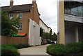
6
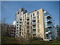
View of Reservoir Apartments from the New River Walkway
Looking north-northwest.
Image: © Robert Lamb
Taken: 29 Mar 2014
0.05 miles
7
View along Woodberry Down #2
Looking south-southwest.
Image: © Robert Lamb
Taken: 29 Mar 2014
0.05 miles
8
View of the Woodberry Down Estate, Lordship Road from the New River Walkway #2
Looking north-northeast.
Image: © Robert Lamb
Taken: 15 Jun 2013
0.05 miles
9
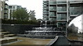
View of a waterfall in the Woodberry Down Estate from the path
Looking north-northeast.
Image: © Robert Lamb
Taken: 15 Jun 2013
0.05 miles
10
View up the pathway to Goodchild Road from the New River Walkway
Looking north-northwest.
Image: © Robert Lamb
Taken: 29 Mar 2014
0.05 miles