IMAGES TAKEN NEAR TO
Surrey Gardens, LONDON, N4 1UD
Introduction
This page details the photographs taken nearby to Surrey Gardens, N4 1UD by members of the Geograph project.
The Geograph project started in 2005 with the aim of publishing, organising and preserving representative images for every square kilometre of Great Britain, Ireland and the Isle of Man.

There are currently over 7.5m images from over14,400 individuals and you can help contribute to the project by visiting https://www.geograph.org.uk
Image Map (116 Images)


Leaflet Map data © OpenStreetMap
Images are licensed for reuse under creativecommons.org/licenses/by-sa/2.0
Notes
- Clicking on the map will re-center to the selected point.
- The higher the marker number, the further away the image location is from the centre of the postcode.
Image Listing (116 Images Found)
Images are licensed for reuse under creativecommons.org/licenses/by-sa/2.0
Image
Details
Distance
1
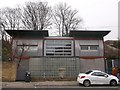
90 Hermitage Road, Harringay
Modern house with glass brick wall and metal panelled sides.
Image: © David Anstiss
Taken: 3 Feb 2013
0.04 miles
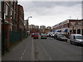
2
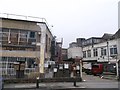
Omega Works, Hermitage Road, Haringey
Two blocks of mixed warehousing units on Hermitage Road.
Am amazed at the variety of different postboxes on the fence!
Shows how many units within the works.
Image: © David Anstiss
Taken: 3 Feb 2013
0.07 miles
3
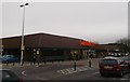
Sainsbury's Harringay
Superstore accessed from Williamson Road.
Image: © David Anstiss
Taken: 3 Feb 2013
0.10 miles
4

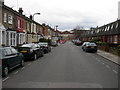
Road Block, Vale Road, N4
Although emergency vehicles can unlock the bollard and get through, nothing else is able to use this road as a shortcut between here Image and here Image Image Without this block, the road would become busy and would have many vans and lorries using it.
Image: © Danny P Robinson
Taken: 13 Mar 2009
0.11 miles
5
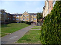
Flats off Finsbury Park Avenue
This estate is between Sainsbury's, the Barking to Gospel Oak Line and Hermitage Road.
Image: © Marathon
Taken: 18 Mar 2015
0.13 miles
7
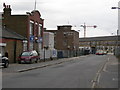
Vale Road, N4 (2)
This is the industrial part of Vale Road.
Image: © Danny P Robinson
Taken: 13 Mar 2009
0.13 miles
9
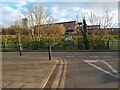
NEW
Eade Road at the end of Linkway
Looking towards the 6th form block of Woodberry Down Academy. The New River runs between the two.
Image: © David Howard
Taken: 12 Mar 2025
0.14 miles
10
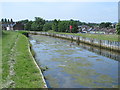
The New River south of Eade Road, N4 (8)
See Image
Image: © Mike Quinn
Taken: 18 Jun 2015
0.15 miles