IMAGES TAKEN NEAR TO
Watsons Road, LONDON, N22 7TZ

Introduction

This page details the photographs taken nearby to Watsons Road, N22 7TZ by members of the Geograph project.

The Geograph project started in 2005 with the aim of publishing, organising and preserving representative images for every square kilometre of Great Britain, Ireland and the Isle of Man.

There are currently over 7.5m images from over14,400 individuals and you can help contribute to the project by visiting https://www.geograph.org.uk

Image Map


Images are licensed for reuse under creativecommons.org/licenses/by-sa/2.0
Notes
  • Clicking on the map will re-center to the selected point.
  • The higher the marker number, the further away the image location is from the centre of the postcode.

Image Listing (216 Images Found)

Images are licensed for reuse under creativecommons.org/licenses/by-sa/2.0
  • ...
Image
Details
Distance
1
Blocks in Wood Green from Alexandra Park
Looking across the whole of east London
Image: © David Howard Taken: 10 Apr 2015
0.06 miles
2
Wood Green bus garage
Operated by Arriva North London, "Recruiting for bus drivers now!".
Image: © Robin Webster Taken: 3 Nov 2012
0.06 miles
3
Ashley House Business Centre
Image: © N Chadwick Taken: 5 Jan 2020
0.06 miles
4
Ashley House Business Centre
Image: © N Chadwick Taken: 5 Jan 2020
0.06 miles
5
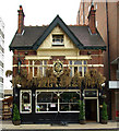
"The Jolly Anglers" public house, Wood Green
Edwardian public house, somewhat sandwiched between two modern buildings
Image: © Jim Osley Taken: 30 May 2011
0.07 miles
6
Wood Green : public house shield plaque
The public house closed in 2019.
Image: © Jim Osley Taken: 6 Nov 2020
0.07 miles
7
Station Road, Wood Green
Looking East
Image: © Oxyman Taken: 29 Apr 2009
0.07 miles
8
7, Bounds Green Rd
Grade II listed. https://historicengland.org.uk/listing/the-list/list-entry/1079256
Image: © N Chadwick Taken: 5 Jan 2020
0.08 miles
9
Arriva Bus Depot
Image: © N Chadwick Taken: 5 Jan 2020
0.08 miles
10
Bus garage, Wood Green
Image: © Christopher Hilton Taken: 9 Feb 2017
0.08 miles
  • ...