IMAGES TAKEN NEAR TO
Sirdar Road, LONDON, N22 6RD
Introduction
This page details the photographs taken nearby to Sirdar Road, N22 6RD by members of the Geograph project.
The Geograph project started in 2005 with the aim of publishing, organising and preserving representative images for every square kilometre of Great Britain, Ireland and the Isle of Man.

There are currently over 7.5m images from over14,400 individuals and you can help contribute to the project by visiting https://www.geograph.org.uk
Image Map
Images are licensed for reuse under creativecommons.org/licenses/by-sa/2.0
Notes
- Clicking on the map will re-center to the selected point.
- The higher the marker number, the further away the image location is from the centre of the postcode.
Image Listing (25 Images Found)
Images are licensed for reuse under creativecommons.org/licenses/by-sa/2.0
Image
Details
Distance
2
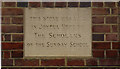
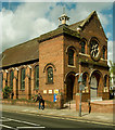
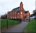
Building stone, Westbury Avenue Baptist Church
Image: © Jim Osley
Taken: 7 May 2013
0.07 miles

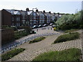
5
Noel Park
Noel Park by Russell Avenue with some improvement work being undertaken
Image: © Shaun Ferguson
Taken: 11 May 2009
0.13 miles
7
Former mission hall, Noel Park
Built in c. 1913 as the Walsham-How Mission Hall in Noel Park, now converted into flats. Overlooked by the compilers of the London North volume of the Buildings of England series.
Image: © Jim Osley
Taken: 10 Jan 2017
0.16 miles
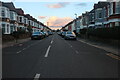
8
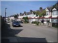
Wood Green: Sandringham Road, N22
The north side of Sandringham Road shown here features a dead straight and level line of between the wars housing.
Image: © Nigel Cox
Taken: 6 Sep 2006
0.16 miles
9
Frome Road
Looking down from Westbury Avenue to the cycle routes by Frome Road
Image: © Shaun Ferguson
Taken: 11 May 2009
0.16 miles
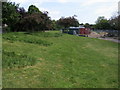
10
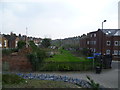
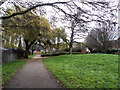
Looking along the line of the old Palace Gates to Seven Sisters railway line
The railway line between Seven Sisters and Palace Gates was opened by the Great Eastern Railway on 1st January 1878 and closed by British Railways to passengers on 7th January 1963 and completely on 5th October 1964. Apart from its route and some of the bridges, very little evidence that it ever existed remains.
This is the view from the bridge carrying Westbury Avenue over the line and looks in the direction of West Green station. The back of the houses in Mannock Road are to the left and those of Graham Road to the right.
A full account of the line with photographs can be seen at http://www.disused-stations.org.uk/w/west_green/index.shtml
Image: © Marathon
Taken: 8 Apr 2015
0.18 miles