IMAGES TAKEN NEAR TO
Bury Road, LONDON, N22 6HX
Introduction
This page details the photographs taken nearby to Bury Road, N22 6HX by members of the Geograph project.
The Geograph project started in 2005 with the aim of publishing, organising and preserving representative images for every square kilometre of Great Britain, Ireland and the Isle of Man.

There are currently over 7.5m images from over14,400 individuals and you can help contribute to the project by visiting https://www.geograph.org.uk
Image Map
Images are licensed for reuse under creativecommons.org/licenses/by-sa/2.0
Notes
- Clicking on the map will re-center to the selected point.
- The higher the marker number, the further away the image location is from the centre of the postcode.
Image Listing (152 Images Found)
Images are licensed for reuse under creativecommons.org/licenses/by-sa/2.0
Image
Details
Distance
1
Entrance to the car park on Lymington Avenue
Image: © Tom Page
Taken: 3 Jan 2021
0.05 miles
2
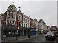
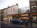
Cheapside, Wood Green
A parade of shops along the High Road.
Image: © Richard Rogerson
Taken: 18 Feb 2016
0.07 miles
8
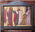
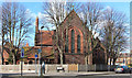
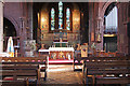
St Mark, Noel Park - Station of the Cross No 1
Image: © John Salmon
Taken: 2 Feb 2013
0.09 miles