1
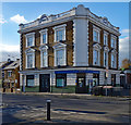
Sloping balconies on Commerce Road, Wood Green
There are similar designs in Primrose Hill and Archway a few miles to the south.
Image: © David Howard
Taken: 19 May 2019
0.06 miles
2
Woodside Park direction sign
Image: © Jim Osley
Taken: 30 Jul 2014
0.08 miles
3
Pavilion and snack bar, Woodside Park
Image: © Jim Osley
Taken: 23 Jul 2014
0.08 miles
4
Wood Green, North London
View from Alexandra Palace.
Image: © Jim Osley
Taken: 13 Nov 2017
0.09 miles
5
Woodside House, Woodside Park, London N22
This building was formerly the Wood Green Town Hall before the re-organisation of the boroughs in the 1960s.
Image: © Christine Matthews
Taken: 9 May 2015
0.10 miles
6
Wood Green : former Fishmonger Arms public house
On the importance of the public house to the popular music industry see this http://www.bowesandbounds.org/m/blogpost?id=6278630%3ABlogPost%3A46792.
Image: © Jim Osley
Taken: 6 Nov 2020
0.11 miles
7
Sir Thomas More Roman Catholic Secondary School
Descriptive notes at
Image]
Image: © Jim Osley
Taken: 31 Mar 2017
0.11 miles
8
Woodside House extension, Wood Green
"Woodside House was built as a private residence in the ‘Italianate’ style around 1865 ... In 1893 the house was bought by the Wood Green Local Board of Health. In 1892 it housed the area’s first public library, and in 1913 a single storey extension was added to house a new council chamber for Wood Green Urban District Council ..." - quoted from this http://www.haringey.gov.uk/libraries-sport-and-leisure/culture-and-entertainment/visiting-haringey/archive-and-local-history/history-woodside-house
Image: © Jim Osley
Taken: 31 Mar 2017
0.11 miles
9
Former Fishmongers Arms public house, Wood Green
Legendary live music venue from the 1950s and 1960s, now put to a more prosaic use as a neighbourhood police office.
Image: © Jim Osley
Taken: 31 Mar 2017
0.11 miles
10
Sir Thomas More Catholic School, Wood Green
Built as Wood Green County School in 1912 to the designs of Middlesex County Council architect Harry George Crothall. Baroque in style.
Image: © Jim Osley
Taken: 23 Jul 2014
0.12 miles


