IMAGES TAKEN NEAR TO
Normans Close, Norman Avenue, LONDON, N22 5ER
Introduction
This page details the photographs taken nearby to Normans Close, Norman Avenue, N22 5ER by members of the Geograph project.
The Geograph project started in 2005 with the aim of publishing, organising and preserving representative images for every square kilometre of Great Britain, Ireland and the Isle of Man.

There are currently over 7.5m images from over14,400 individuals and you can help contribute to the project by visiting https://www.geograph.org.uk
Image Map
Images are licensed for reuse under creativecommons.org/licenses/by-sa/2.0
Notes
- Clicking on the map will re-center to the selected point.
- The higher the marker number, the further away the image location is from the centre of the postcode.
Image Listing (25 Images Found)
Images are licensed for reuse under creativecommons.org/licenses/by-sa/2.0
Image
Details
Distance
1
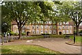
Topham Square, Tower Gardens Estate, Tottenham
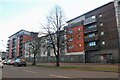
The flats in Topham Square were the last development of the Tower Gardens Estate, completed in 1924 to the designs of London County Council architect George Topham Forrest.
Image: © Jim Osley
Taken: 29 Sep 2016
0.09 miles
2
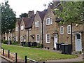
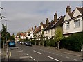
Tower Gardens Conservation Area : housing terrace, Gospatrick Road
Image: © Jim Osley
Taken: 12 May 2020
0.10 miles
4
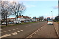
Roundway, Tottenham
Looking towards Granville Road
Image: © David Howard
Taken: 23 Jan 2021
0.14 miles
6
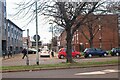
Chesthunte Road, Tower Gardens Estate, Tottenham
Image: © Jim Osley
Taken: 27 Sep 2016
0.16 miles
7
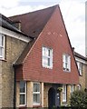
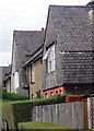
Tower Gardens Conservation Area : tile-hung house, Wateville Road
Image: © Jim Osley
Taken: 12 May 2020
0.18 miles
8
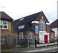
Trinity African Methodist Episcopal Zion Church, Tower Gardens Estate
Image: © Jim Osley
Taken: 30 Jan 2018
0.19 miles
9
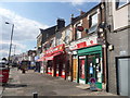
Wood Green: Lordship Lane Post Office
The post office is at the eastern extremity of the Wood Green (N22) postal area, but halfway along Lordship Lane, the main road east from central Wood Green. Its address is 482 (lower numbers are behind us) and it has been here or hereabouts since 1907. (There used to be another office named Lordship Lane, further east under N17, from 1911 to 2004.)
Image: © Chris Downer
Taken: 12 Sep 2014
0.19 miles
10
Tower Gardens Conservation Area : housing terrace, Kevelioc Road
Image: © Jim Osley
Taken: 12 May 2020
0.21 miles