1
The Dog and Duck, Winchmore Hill
A popular real ale pub, the Dog and Duck is located on Hoppers Road close to the boundary between Winchmore Hill and Palmers Green. Originally constructed as two cottages, it was granted a licence to sell ale in the 18th century. The pub's name derives from the fact that it is situated close to the junction with Bourne Hill, which was formerly known as Dog and Duck Lane. The pub was rebuilt in 1900.
Sources: http://www.palmersgreenn13.com/places-2/inns-and-pubs/old-stagers/
http://www.palmersgreenn13.com/timeline/
Image: © Paul Bryan
Taken: 1 Mar 2015
0.02 miles
2
The Dog and Duck, Winchmore Hill
A popular real ale pub, the Dog and Duck is located on Hoppers Road close to the boundary between Winchmore Hill and Palmers Green. Originally constructed as two cottages, it was granted a licence to sell ale in the 18th century. The pub's name derives from the fact that it is situated close to the junction with Bourne Hill, which was formerly known as Dog and Duck Lane. The pub was rebuilt in 1900.
Sources: http://www.palmersgreenn13.com/places-2/inns-and-pubs/old-stagers/
http://www.palmersgreenn13.com/timeline/
Image: © Paul Bryan
Taken: 1 Mar 2015
0.02 miles
3
The Dog and Duck, Palmers Green
Image: © John H Darch
Taken: 1 May 2012
0.02 miles
4
Railway line in Palmers Green
Heading northbound
Image: © David Howard
Taken: 6 Oct 2021
0.06 miles
5
Old and New Bridges over the Railway, Bourne Hill
Here you can see the modern bridge over the railway in Bourne Hill leading to the road junction of Bourne Hill, Green Lanes and Hedge Lane, which then leads to the Cambridge Roundabout on the A10, Great Cambridge Road. To the left of this bridge you can see the old bridge, which is still used as a foot bridge.
Image: © Christine Matthews
Taken: 9 Sep 2005
0.07 miles
6
"Dog and Duck" public house, Palmers Green
Image: © Jim Osley
Taken: 31 Mar 2016
0.07 miles
7
Railway north of A111 Bourne Hill
This is the Hertford Loop Line served by trains from Moorgate or Kings Cross.
Image: © Robin Webster
Taken: 3 Nov 2012
0.07 miles
8
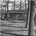
173 North London Scout Group hut, Bourne Hill
The site of this hut beside the railway line has been given over to private housing. In my scouting days (1950s) there were two huts here. One for all the stores needed for camping and the other (in the picture) open plan for the meeting of the scouts. The open space was great for barbecues and outside scout training.
Image: © Julian Paren
Taken: Unknown
0.07 miles
9
Palmers Green Telephone Exchange
Image: © Jim Osley
Taken: 31 Mar 2016
0.08 miles
10
Telephone Exchange, Bourne Hill, Palmers Green
This typical telephone exchange building is in Bourne Hill not far from the junction of Bourne Hill and Hoppers Road
Image: © Christine Matthews
Taken: 9 Sep 2005
0.08 miles


