IMAGES TAKEN NEAR TO
Highfield Road, LONDON, N21 3HA
Introduction
This page details the photographs taken nearby to Highfield Road, N21 3HA by members of the Geograph project.
The Geograph project started in 2005 with the aim of publishing, organising and preserving representative images for every square kilometre of Great Britain, Ireland and the Isle of Man.

There are currently over 7.5m images from over14,400 individuals and you can help contribute to the project by visiting https://www.geograph.org.uk
Image Map
Images are licensed for reuse under creativecommons.org/licenses/by-sa/2.0
Notes
- Clicking on the map will re-center to the selected point.
- The higher the marker number, the further away the image location is from the centre of the postcode.
Image Listing (131 Images Found)
Images are licensed for reuse under creativecommons.org/licenses/by-sa/2.0
Image
Details
Distance
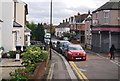
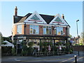
4
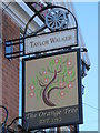
Sign for The Orange Tree, Highfield Road, N21
See Image
Image: © Mike Quinn
Taken: 14 Oct 2015
0.02 miles
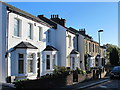
5
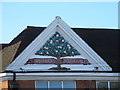
Sign on The Orange Tree, Highfield Road, N21
See Image
Image: © Mike Quinn
Taken: 14 Oct 2015
0.02 miles
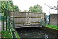
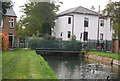
7
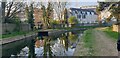
Road and footbridges over the New River, Highfield Road, N21 (2)
See Image
Image: © Mike Quinn
Taken: 14 Oct 2015
0.02 miles
8
New River Footpath, Palmers Green, North London
Looking east along the New River. I liked the cherry blossom on the left.
Image: © Christine Matthews
Taken: 19 Apr 2021
0.03 miles
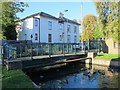
9
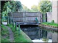
Bridge over the New River at Highfield Road, N21
See Image
Image: © Mike Quinn
Taken: 9 Sep 2015
0.03 miles