IMAGES TAKEN NEAR TO
West Hill Way, LONDON, N20 8QX
Introduction
This page details the photographs taken nearby to West Hill Way, N20 8QX by members of the Geograph project.
The Geograph project started in 2005 with the aim of publishing, organising and preserving representative images for every square kilometre of Great Britain, Ireland and the Isle of Man.

There are currently over 7.5m images from over14,400 individuals and you can help contribute to the project by visiting https://www.geograph.org.uk
Image Map
Images are licensed for reuse under creativecommons.org/licenses/by-sa/2.0
Notes
- Clicking on the map will re-center to the selected point.
- The higher the marker number, the further away the image location is from the centre of the postcode.
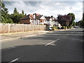
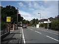
Image Listing (31 Images Found)
Images are licensed for reuse under creativecommons.org/licenses/by-sa/2.0
Image
Details
Distance
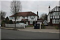
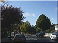
3
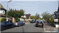
Oak Tree Drive, Totteridge
A quiet residential street in Totteridge.
Image: © Peter Mackenzie
Taken: 10 Sep 2019
0.12 miles

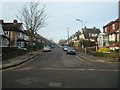
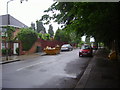
8
Longland Drive, Totteridge
Longland Drive, first turning left from Totteridge Lane after you pass the Dollis Valley Green Space.
Image: © Christine Matthews
Taken: 20 Oct 2005
0.18 miles