1
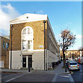
King's Cross : housing terrace, Balfe Street
Grade II listed : description at this https://historicengland.org.uk/listing/the-list/list-entry/1204449.
Image: © Jim Osley
Taken: 21 Nov 2018
0.02 miles
2
Victorian school conversion, York Way
Image: © Jim Osley
Taken: 2 Feb 2014
0.03 miles
3
Geffrye meets his Waterloo (133)
Lamppost in Railway Street
Image: © Basher Eyre
Taken: 2 Apr 2016
0.03 miles
4
York Way N1
From the junction with Crinan Street N1
Image: © Robin Sones
Taken: 14 Jul 2009
0.03 miles
5
Geffrye meets his Waterloo (132)
Railway Street- referring to the nearby Kings Cross Railway Station https://en.wikipedia.org/wiki/London_King%27s_Cross_railway_station
Image: © Basher Eyre
Taken: 2 Apr 2016
0.03 miles
6
Railway St
Image: © N Chadwick
Taken: 5 Jan 2020
0.03 miles
7
Balfe Street at the east end of Railway Street, King's Cross, London
Image: © Robin Stott
Taken: 29 Mar 2015
0.03 miles
8
End terrace, Balfe Street, N1
The terrace, built about 1847, is grade II listed. The near end house seems to have been converted back to a house from a shop or office, the listing description talks of a 20th century shop or office front, of which there is now no sign. Also a curved chamfer to its corner seems to have gone.
Image: © Robin Webster
Taken: 21 Nov 2015
0.03 miles
9
Railway Street, King's Cross
Not much traffic has evidently used this street which connects York Way and Balfe Street just east of King's Cross station. Snow is continuing to fall during the worst weather conditions London has experienced for nearly two decades.
Image: © Stephen McKay
Taken: 2 Feb 2009
0.03 miles
10
Railway Street housing development
The street takes its name from Kings Cross station nearby. This photos shows infill housing development to the rear of the former London General Omnibus Co. stables.
Image: © Stephen Craven
Taken: 9 Mar 2013
0.03 miles


