1
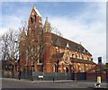
Hargreave Park School
Image: © N Chadwick
Taken: 7 Oct 2021
0.05 miles
2
Hargreave Park School
Image: © N Chadwick
Taken: 7 Oct 2021
0.05 miles
3
Little Angels Nursery, Bredgar Road, Upper Holloway, London N19
Built in 1979 as a church.
Image: © John Salmon
Taken: 24 Feb 2008
0.06 miles
4
Little Angels Nursery, Bredgar Road, Upper Holloway, London N19
This was St Peter's Church new church, built in 1979. The previous St Peter's Church can be seen in the background.
Image: © John Salmon
Taken: 24 Feb 2008
0.08 miles
5
Former St Peter's Church, Dartmouth Park
St Peter's Church was originally known as St Peter's Highgate Hill. The church was opened on 15 November 1874 and a parish was created out of the parish of St John, Upper Holloway in December 1880. In 1978 St Peter's was united with St John's to become the parish of St Peter with St John, Upper Holloway before its conversion into residential accommodation. The architect was C.L. Luck.
Image: © Jim Osley
Taken: 12 Oct 2017
0.08 miles
6
St Peter, Bredgar Road, Upper Holloway, London N19
This church has been converted into flats.
Image: © John Salmon
Taken: 3 Feb 2008
0.08 miles
7
Hargrave Place N19 Fading Anti-Nuclear Wall Art
This smiley face anti-nuclear power wall painting is now quite faded but reads 'nuclear power no thank you'. I first saw it in the 1980's when it was quite readable and I suspect it dates from the mid to late 1970's. At that time Islington Council were demolishing much of the old housing stock in the area and some properties were squatted before they came down. In 1979 this anti-nuclear symbol was quite ubiquitous in western Europe and I had a German badge that read 'atomkraft nein danke' and I guess I thought I was cool.
Image: © John Kingdon
Taken: 31 Aug 2024
0.08 miles
8
Bredgar Rd
Image: © N Chadwick
Taken: 7 Oct 2021
0.09 miles
9
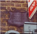
Old Boundary Marker by Dartmouth Park Hill, Highgate and Muswell Hill Parish
Parish Boundary Marker by the UC road, in parish of Highgate and Muswell Hill (Islington District), Dartmouth Park Hill N19, corner with Bredgar Road, attached to first floor wall of No 122 Dartmouth Park Hill.
Surveyed
Milestone Society National ID: MX_SMI04pb.
Image: © Milestone Society
Taken: Unknown
0.09 miles
10
Entrance lodge, Highgate Cemetery
Image: © Jim Osley
Taken: 23 Mar 2014
0.09 miles


