IMAGES TAKEN NEAR TO
Hazel Close, LONDON, N19 5XH

Introduction

This page details the photographs taken nearby to Hazel Close, N19 5XH by members of the Geograph project.

The Geograph project started in 2005 with the aim of publishing, organising and preserving representative images for every square kilometre of Great Britain, Ireland and the Isle of Man.

There are currently over 7.5m images from over14,400 individuals and you can help contribute to the project by visiting https://www.geograph.org.uk

Image Map


Images are licensed for reuse under creativecommons.org/licenses/by-sa/2.0
Notes
  • Clicking on the map will re-center to the selected point.
  • The higher the marker number, the further away the image location is from the centre of the postcode.

Image Listing (206 Images Found)

Images are licensed for reuse under creativecommons.org/licenses/by-sa/2.0
  • ...
Image
Details
Distance
1
Hargrave Park
Image: © Oast House Archive Taken: 25 Jan 2018
0.08 miles
2
Hargreave Park School
Image: © N Chadwick Taken: 7 Oct 2021
0.09 miles
3
Hargreave Park School
Image: © N Chadwick Taken: 7 Oct 2021
0.09 miles
4
Not useful for communication anymore
Image: © N Chadwick Taken: 7 Oct 2021
0.10 miles
5
Oak & Pastor
Image: © N Chadwick Taken: 14 Oct 2023
0.10 miles
6
The Oak & Pastor on Junction Road
Image: © Ian S Taken: 1 Mar 2014
0.10 miles
7
St Christopher's Court, Junction Road
It is not an uncommon sight in London to find redundant churches converted to residential use. The building began life as the Junction Road Congregational Church, built in 1866 to the designs of architect W.F. Poulton. It continued as a place of Christian worship in 1978, after which it became Samaj Hall, a Hindu organization. At some point thereafter the building conversion took place.
Image: © Jim Osley Taken: 22 Jan 2015
0.10 miles
8
St Christophers Court, Junction Road
It is not an uncommon sight in London to find redundant churches converted to residential use. The building began life as the Junction Road Congregational Church, built in 1866 to the designs of architect W.F. Poulton. It continued as a place of Christian worship in 1978, after which it became Samaj Hall, a Hindu organization. At some point thereafter the building conversion took place. Another view at Image
Image: © Jim Osley Taken: 25 Mar 2016
0.10 miles
9
Flats on Bredgar Road off Junction Road
Image: © Ian S Taken: 1 Mar 2014
0.10 miles
10
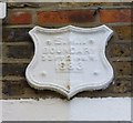
Old Boundary Marker by Dartmouth Park Hill
Parish Boundary Marker by the UC road, in parish of Highgate And Muswell Hill (Islington District), Dartmouth Park Hill N19, attached to wall above porches of Nos. 90 & 92. Surveyed Milestone Society National ID: MX_SMI03pb.
Image: © Milestone Society Taken: Unknown
0.10 miles
  • ...