1
Dartmouth Park Hill
Image: © David Howard
Taken: 31 Oct 2014
0.02 miles
2
Bramshill Gardens, Dartmouth Park
Seen at the junction with Dartmouth Park Avenue. Perhaps because it has no station named after it, or because it is tucked away between Kentish Town and Highgate, Dartmouth Park is a relatively little known Victorian suburb; it is nevertheless an intriguing place. The Earl of Dartmouth acquired the land in the middle of the 18th century, but the area was not developed for another century. The streets tend to be a little narrower and have a more intimate quality than similar contemporary suburbs.
Image: © Stephen McKay
Taken: 22 Jul 2008
0.05 miles
3
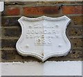
Old Boundary Marker by Dartmouth Park Hill
Parish Boundary Marker by the UC road, in parish of Highgate And Muswell Hill (Islington District), Dartmouth Park Hill N19, attached to wall above porches of Nos. 90 & 92.
Surveyed
Milestone Society National ID: MX_SMI03pb.
Image: © Milestone Society
Taken: Unknown
0.05 miles
4
Hargrave Place N19 Fading Anti-Nuclear Wall Art
This smiley face anti-nuclear power wall painting is now quite faded but reads 'nuclear power no thank you'. I first saw it in the 1980's when it was quite readable and I suspect it dates from the mid to late 1970's. At that time Islington Council were demolishing much of the old housing stock in the area and some properties were squatted before they came down. In 1979 this anti-nuclear symbol was quite ubiquitous in western Europe and I had a German badge that read 'atomkraft nein danke' and I guess I thought I was cool.
Image: © John Kingdon
Taken: 31 Aug 2024
0.08 miles
5
Housing terrace, Winscombe Street
The image hows part of a housing terrace built in the 1960s to a design by architect Neave Brown. It is Grade II listed : description at this https://historicengland.org.uk/listing/the-list/list-entry/1410085. Neave Brown was an important figure in the development of social housing projects in the London Borough of Camden. His contribution belatedly received recognition with the award of the Royal Institute of British Architects Royal Gold Medal 2017.
Image: © Jim Osley
Taken: 12 Oct 2017
0.08 miles
6
Housing terrace, Winscombe Street
Image: © Jim Osley
Taken: 12 Oct 2017
0.08 miles
7
Distant London view
Image: © Peter S
Taken: 9 Sep 2009
0.09 miles
8
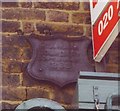
Old Boundary Marker by Dartmouth Park Hill, Highgate and Muswell Hill Parish
Parish Boundary Marker by the UC road, in parish of Highgate and Muswell Hill (Islington District), Dartmouth Park Hill N19, corner with Bredgar Road, attached to first floor wall of No 122 Dartmouth Park Hill.
Surveyed
Milestone Society National ID: MX_SMI04pb.
Image: © Milestone Society
Taken: Unknown
0.12 miles
9
Hargreave Park School
Image: © N Chadwick
Taken: 7 Oct 2021
0.12 miles
10
Hargreave Park School
Image: © N Chadwick
Taken: 7 Oct 2021
0.12 miles


