IMAGES TAKEN NEAR TO
Levison Way, LONDON, N19 3XF
Introduction
This page details the photographs taken nearby to Levison Way, N19 3XF by members of the Geograph project.
The Geograph project started in 2005 with the aim of publishing, organising and preserving representative images for every square kilometre of Great Britain, Ireland and the Isle of Man.

There are currently over 7.5m images from over14,400 individuals and you can help contribute to the project by visiting https://www.geograph.org.uk
Image Map (Loading...)


Getting Data...Please wait
Leaflet Map data © OpenStreetMap
Images are licensed for reuse under creativecommons.org/licenses/by-sa/2.0
Notes
- Clicking on the map will re-center to the selected point.
- The higher the marker number, the further away the image location is from the centre of the postcode.
Image Listing (266 Images Found)
Images are licensed for reuse under creativecommons.org/licenses/by-sa/2.0
Image
Details
Distance
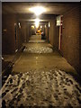
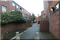
1
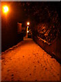
Alley from St John's Way to Turpin Way N19
Image: © Robin Sones
Taken: 18 Dec 2010
0.02 miles
4
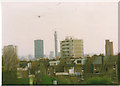
View across Central London from Highgate, 1994
This was most probably taken from my friend's top floor window on Highgate Hill, with what was the Telecom Tower in the centre with Euston Tower on the left. The buildings behind are around Bloomsbury and towards Soho.
Image: © David Howard
Taken: Unknown
0.05 miles
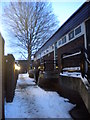
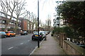
7
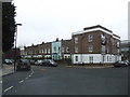
Corner of Grovedale Road and Boothby Road, Archway
Image: © Chris Whippet
Taken: 15 Dec 2008
0.07 miles
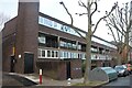
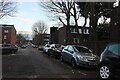
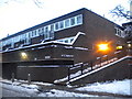
8
Housing estate on Ashbrook Road, Archway
Image: © David Howard
Taken: 2 Jan 2021
0.08 miles