IMAGES TAKEN NEAR TO
Davenant Road, LONDON, N19 3NN
Introduction
This page details the photographs taken nearby to Davenant Road, N19 3NN by members of the Geograph project.
The Geograph project started in 2005 with the aim of publishing, organising and preserving representative images for every square kilometre of Great Britain, Ireland and the Isle of Man.

There are currently over 7.5m images from over14,400 individuals and you can help contribute to the project by visiting https://www.geograph.org.uk
Image Map
Images are licensed for reuse under creativecommons.org/licenses/by-sa/2.0
Notes
- Clicking on the map will re-center to the selected point.
- The higher the marker number, the further away the image location is from the centre of the postcode.
Image Listing (184 Images Found)
Images are licensed for reuse under creativecommons.org/licenses/by-sa/2.0
Image
Details
Distance
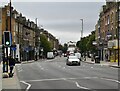
4
'Angies of Holloway Road'
I expect the owners of this Victorian public house near Upper Holloway station thought it would be trendy to give it this name. Sorry, I don't do trendy.
Image: © Dr Neil Clifton
Taken: 28 Nov 2007
0.05 miles
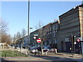
8
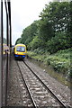
DMU northeast of Upper Holloway Station
Diesel multiple unit Turbostar Class 172/0 number 172 007 passes a charter train heading SW.
Image: © Roger Templeman
Taken: 17 Sep 2011
0.08 miles