IMAGES TAKEN NEAR TO
Cheverton Road, LONDON, N19 3AZ

Introduction

This page details the photographs taken nearby to Cheverton Road, N19 3AZ by members of the Geograph project.

The Geograph project started in 2005 with the aim of publishing, organising and preserving representative images for every square kilometre of Great Britain, Ireland and the Isle of Man.

There are currently over 7.5m images from over14,400 individuals and you can help contribute to the project by visiting https://www.geograph.org.uk

Image Map


Images are licensed for reuse under creativecommons.org/licenses/by-sa/2.0
Notes
  • Clicking on the map will re-center to the selected point.
  • The higher the marker number, the further away the image location is from the centre of the postcode.

Image Listing (119 Images Found)

Images are licensed for reuse under creativecommons.org/licenses/by-sa/2.0
  • ...
Image
Details
Distance
1
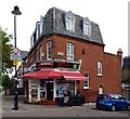
Corner shop, Cressida Road, Upper Holloway
Image: © Jim Osley Taken: 26 Oct 2016
0.05 miles
2
Hillside Park, London N19
Image: © John Salmon Taken: 6 Jul 2015
0.06 miles
3
Gresley Road at the junction of Ashmount Road
Image: © David Howard Taken: 17 Oct 2013
0.09 miles
4
St Andrew's Church, Whitehall Park
Built 1894-1895 to the designs of architect Frederick Hammond. (Information from: The Buildings of England. London. 4: North)
Image: © Jim Osley Taken: 16 Jan 2015
0.12 miles
5
Whitehall Park
A pleasant side street off Hornsey Lane.
Image: © Martin Addison Taken: 22 May 2009
0.13 miles
6
Dresden Road looking towards Hazelville Road
Image: © David Howard Taken: 17 Oct 2013
0.14 miles
7
School on Hornsey Lane
This is the old school as it looked in 2015. It has now been demolished and replaced with a new building that houses the Whitehall Park School. It is a "free" school run by BPET the Bellevue Place Education Trust
Image: © Nigel Mykura Taken: 23 Aug 2015
0.14 miles
8
St Andrews, Whitehall Park
Anglican church on the corner of Whitehall Park and Gladsmuir Road.
Image: © Stephen McKay Taken: 16 Nov 2007
0.14 miles
9
131 St. John’s Way Benchmark
Image: © Cipollini Taken: 6 Aug 2024
0.15 miles
10
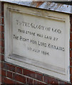
St Andrew, Whitehall Park, Upper Holloway - Foundation stone
Image: © John Salmon Taken: 6 Jul 2015
0.16 miles
  • ...