1
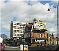
A1010 going north Tottenham N17
Image: © John Salmon
Taken: 5 Mar 2007
0.07 miles
2
The Gilpin's Bell, 50-54 Fore Street, Upper Edmonton, London N18
This rather grim looking building (on the outside) is occupied by a J D Wetherspoon public house known as The Gilpin's Bell. According to their website, the name recalls the Bell Inn, which stood on the west side of Fore Street. That pub was immortalised by William Cowper in his best-selling 18th-century ballad "The Diverting History of John Gilpin". J D Wetherspoon opened this pub in 1998. Being near the Tottenham Hotspur football ground, on match days it is only open to home match day fans.
Image: © P L Chadwick
Taken: 28 Sep 2013
0.08 miles
3
LT's Bar (formerly the Phoenix), 56 Fore Street, Upper Edmonton, London N18
Another local pub which understandably supports the home football team, Tottenham Hotspurs. This pub was for many years known as the Phoenix. It appears as such in the 1911 census. It was also in the 1891 census but no name is given. It was described as a beerhouse. Close examination of the stonework at the front, between the ground and first floors, appears to show carvings of a phoenix. Unfortunately they have been semi-obliterated with dark blue paint.
Image: © P L Chadwick
Taken: 28 Sep 2013
0.10 miles
4
Leaving the Angel Edmonton, London N17
Image: © John Salmon
Taken: 5 Mar 2007
0.10 miles
5
Vicarage Road, London N17
Image: © John Salmon
Taken: 5 Mar 2007
0.11 miles
6
Ruya Dems Meat, 66 Fore Street, Upper Edmonton, London N18
This Halal butcher is on the corner of Alpha Road and Fore Street. Halal is Arabic for permissable and indicates the method used to slaughter the animal in accordance with Islamic law. Next door is an estate agent and next to that a branch of Paddy Power, the bookmaker.
Image: © P L Chadwick
Taken: 28 Sep 2013
0.11 miles
7
Demolition site, Tottenham
Most recently a car mat factory.
Image: © Robin Webster
Taken: 11 Nov 2012
0.12 miles
8
A1010 going north Tottenham N17
Image: © John Salmon
Taken: 5 Mar 2007
0.12 miles
9
The Coach & Horses (1), 862 High Road, Tottenham, London N17
This old public house is located on the corner of High Road (part of the A1010) and Brantwood Road. It dates from 1826 and was formerly a Truman house but today it is a free house owned by Woolwich Taverns.
Image
Image: © P L Chadwick
Taken: 28 Sep 2013
0.14 miles
10
The Coach & Horses (2) - sign, 862 High Road, Tottenham, London N17
The rather faded sign illustrates the pub's name.
Image
Image: © P L Chadwick
Taken: 28 Sep 2013
0.14 miles


