1
Park Road, Edmonton
Park Road is a minor road in Edmonton, in the suburbs of north London. Here, the road passes beneath a railway line. Signs warn that the bridge is low, however the road has subsequently been closed to motor vehicles. Painted markings on the road surface indicate that the road forms part of the route of London's Cycleway 1.
Image: © Malc McDonald
Taken: 11 Dec 2021
0.06 miles
2
Solomon Avenue, Edmonton
Solomon Avenue is a residential road in a modern housing development in Edmonton, in the suburbs of north London.
Image: © Malc McDonald
Taken: 11 Dec 2021
0.08 miles
3
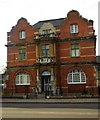
Former Passmore Edwards Library, Fore Street, Edmonton
View of central elevation
Image: © Jim Osley
Taken: 9 Dec 2010
0.09 miles
4
Former Passmore Edwards Library, Fore Street, Edmonton
View of entrance to Lending Library, 1931 extension to the main library
Image: © Jim Osley
Taken: 9 Dec 2010
0.09 miles
5
Former Passmore Edwards Library, Fore Street, Edmonton
Edmonton's former Central Library was built to the designs of Maurice B. Adams (1849-1933), an architect most associated with Bedford Park. The building dates from 1897: it closed in 1991, and is currently in use a mosque. For more on John Passmore Edwards and his philanthropic work visit http://www.passmoreedwards.org.uk/
Also illustrated at:
Image
Image
Image: © Jim Osley
Taken: 9 Dec 2010
0.09 miles
6
The lake in Pymmes Park
Pymmes Lake was once part of the Pymmes Estate. The name came from a wealthy landowner called William Pymme who built a mansion nearby in 1327. In the 16th century the land was owned by Lord Burghley and later by Robert Cecil, Earl of Salisbury.
The northern 33 acres of Pymmes Park was opened to the public in 1897, while the remaining 20 acres was established as an ornamental park and formally opened to the public on 16th June 1906. Victorian and Edwardian visitors to Pymmes Park used the lake for pleasure boating. Rowing boats and children's paddleboats were used on the lake until the late 1970s when the lake was turned into a wildlife sanctuary. The house itself burned down in 1940.
Image: © Marathon
Taken: 23 Sep 2015
0.10 miles
7
Pymme's Brook, Edmonton
Pymme's Brook is a minor tributary of the River Lea (or Lee) in north London. This photograph was taken from the platform of Silver Street railway station, which straddles the brook.
Image: © Malc McDonald
Taken: 11 Dec 2021
0.11 miles
8
Silver Street Railway Station
Image: © Stacey Harris
Taken: 29 Jan 2008
0.11 miles
9
Restaurant on the corner, Fore Street
Still looking very much like a pub, but now trading as the Capital Restaurant.
Image: © Des Blenkinsopp
Taken: 9 Oct 2018
0.12 miles
10
Pymme's Park, Edmonton
Pymme's Park is a park in Edmonton, in the suburbs of north London. This image was taken on a dull and damp December afternoon.
Image: © Malc McDonald
Taken: 11 Dec 2021
0.12 miles


