IMAGES TAKEN NEAR TO
Vestry Street, LONDON, N1 7SS
Introduction
This page details the photographs taken nearby to Vestry Street, N1 7SS by members of the Geograph project.
The Geograph project started in 2005 with the aim of publishing, organising and preserving representative images for every square kilometre of Great Britain, Ireland and the Isle of Man.

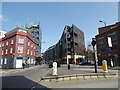
There are currently over 7.5m images from over14,400 individuals and you can help contribute to the project by visiting https://www.geograph.org.uk
Image Map (416 Images)


Getting Data...Please wait
Leaflet Map data © OpenStreetMap
Images are licensed for reuse under creativecommons.org/licenses/by-sa/2.0
Notes
- Clicking on the map will re-center to the selected point.
- The higher the marker number, the further away the image location is from the centre of the postcode.
Image Listing (416 Images Found)
Images are licensed for reuse under creativecommons.org/licenses/by-sa/2.0
Image
Details
Distance
1
Geffrye meets his Waterloo (210)
Vestry Street
Image: © Basher Eyre
Taken: 2 Apr 2016
0.01 miles
2
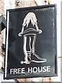
Sign for The Duke of Wellington, Nile Street, N1
See Image
Image: © Mike Quinn
Taken: 5 Aug 2009
0.02 miles
3
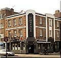
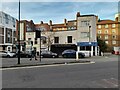
"The Duke of Wellington" public house, Nile Street
Locally listed inter-war public house.
Image: © Jim Osley
Taken: 7 Sep 2014
0.02 miles
4
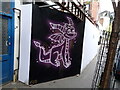
View of Spyro street art on Nile Street
Looking north-northeast.
Image: © Robert Lamb
Taken: 11 Apr 2021
0.02 miles
5
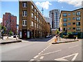
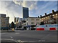
Hackney, East Road
The junction of East Road (A1200) and Vestry Road.
Image: © David Dixon
Taken: 26 May 2015
0.02 miles
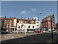
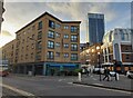
6
East Road at the junction of Nile Street
Image: © David Howard
Taken: 7 Nov 2021
0.02 miles
7

View of Jigglypuff street art on Nile Street
Looking north-northwest.
Image: © Robert Lamb
Taken: 11 Apr 2021
0.02 miles
9
Geffrye meets his Waterloo (211)
Vestry Street merges with East Road
Image: © Basher Eyre
Taken: 2 Apr 2016
0.02 miles