1
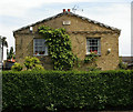
Church Road, Tottenham
Church Road is a minor road in Tottenham, in the suburbs of north London. This image was taken as darkness fell on a damp and gloomy December afternoon.
Image: © Malc McDonald
Taken: 11 Dec 2021
0.05 miles
2
Bruce Castle Park Plus Rainbow
A wintry day in the park. To the left of the houses in the middle of the photo is the community owned pub, The Antwerp Arms, known to regulars as "The Annie".
Image: © John Kingdon
Taken: 15 Jan 2020
0.05 miles
3
"The Antwerp Arms" public house, Tottenham
Example of a public house saved from closure by the local community.
Image: © Jim Osley
Taken: 8 Nov 2016
0.07 miles
4
The Antwerp Arms, Tottenham
The Antwerp Arms pub in a residential neighbourhood in Tottenham, in the suburbs of north London. This image was taken as darkness fell on a wet and gloomy December afternoon.
Image: © Malc McDonald
Taken: 11 Dec 2021
0.08 miles
5
Prospect Place, Tottenham (built 1829)
View from Tottenham Cemetery of one of the properties comprising Prospect Place, a Grade II listed terrace, described at this http://list.english-heritage.org.uk/resultsingle.aspx?uid=1189338.
Image: © Jim Osley
Taken: 5 May 2014
0.09 miles
6
Tottenham Cemetery The Dark and the Light
A funeral was over and the dark skies seemed about to douse the light. It seemed a perfect metaphor for death.
Image: © John Kingdon
Taken: 15 Jan 2020
0.10 miles
7
Headcorn Road, Tottenham
Headcorn Road forms part of a housing estate in Tottenham, in the suburbs of north London. This image was taken as darkness fell on a dull and damp December afternoon.
Image: © Malc McDonald
Taken: 11 Dec 2021
0.10 miles
8
Tottenham Cemetery and football ground
Looking towards Church Lane and the community owned Antwerp Arms pub the new Spurs football stadium hovers in the background like it had just landed.
Image: © John Kingdon
Taken: 31 May 2019
0.10 miles
9
Pair of chapels, Tottenham Cemetery (1856-57)
Architect: George Prichett. Grade II listed building, described at this https://historicengland.org.uk/listing/the-list/list-entry/1084330
Image: © Jim Osley
Taken: 3 Jun 2013
0.11 miles
10
Tottenham : Haringey Mortuary
Image: © Jim Osley
Taken: 6 Nov 2020
0.12 miles


