1
Tower Gardens Conservation Area : housing terrace, Kevelioc Road
Image: © Jim Osley
Taken: 12 May 2020
0.05 miles
2
Tower Gardens Conservation Area : timber porch, Siward Road
Image: © Jim Osley
Taken: 12 May 2020
0.05 miles
3
Corner house, Tower Gardens Estate, Tottenham
The Tower Gardens Estate is described and assessed at this https://municipaldreams.wordpress.com/2013/07/16/the-white-hart-lane-estate-tottenham-houses-the-very-best-of-their-kind/.
Image: © Jim Osley
Taken: 4 May 2016
0.06 miles
4
Tower Gardens Conservation Area : tile-hung house, Wateville Road
Image: © Jim Osley
Taken: 12 May 2020
0.08 miles
5
Gospatrick Road, Tottenham
The Tower Gardens Estate was London's first garden suburb. For more information, see
Image
Image: © Mary and Angus Hogg
Taken: 19 Jun 2019
0.08 miles
6
Housing terrace, Waltheof Avenue
Waltheof Avenue is in the heart of the Tower Gardens Estate, about which more at this https://municipaldreams.wordpress.com/2013/07/16/the-white-hart-lane-estate-tottenham-houses-the-very-best-of-their-kind/.
Image: © Jim Osley
Taken: 4 May 2016
0.08 miles
7
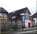
Trinity African Methodist Episcopal Zion Church, Tower Gardens Estate
Image: © Jim Osley
Taken: 30 Jan 2018
0.09 miles
8
Atlas Equipment Company, 339 Lordship Lane, London N22
The company specialised in equipment for bakeries which they may have manufactured. The building was demolished in 2006 and the site redeveloped as an apartment block.
Image: © Arb
Taken: 9 Jun 2006
0.10 miles
9
347-351 Lordship Lane, London N17
This trio was particularly attractive at the time of the photo having retained their original doors, windows, garden walls and privet hedges. Sadly, all but one now sport µPVC.
Image: © Arb
Taken: 9 Jun 2006
0.10 miles
10
341-385 Lordship Lane, London N17
An attractive row of terraced houses built c1935.
Image: © Arb
Taken: 9 Jun 2006
0.12 miles


