1
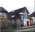
37 - 41 (odds) Henningham Road, N17
In the Tower Gardens conservation area, formerly the White Hart Lane Estate of the LCC.
Image: © Robin Webster
Taken: 11 Nov 2012
0.06 miles
2
Housing terrace, Waltheof Avenue
Waltheof Avenue is in the heart of the Tower Gardens Estate, about which more at this https://municipaldreams.wordpress.com/2013/07/16/the-white-hart-lane-estate-tottenham-houses-the-very-best-of-their-kind/.
Image: © Jim Osley
Taken: 4 May 2016
0.08 miles
3
Tower Gardens Conservation Area : timber porch, Siward Road
Image: © Jim Osley
Taken: 12 May 2020
0.10 miles
4
Gospatrick Road, Tottenham
The Tower Gardens Estate was London's first garden suburb. For more information, see
Image
Image: © Mary and Angus Hogg
Taken: 19 Jun 2019
0.10 miles
5
Houses, Risley Avenue, Tower Gardens Estate
"Butterfly junction" houses on the Tower Gardens Estate : more at this https://municipaldreams.wordpress.com/2013/07/16/the-white-hart-lane-estate-tottenham-houses-the-very-best-of-their-kind/.
Image: © Jim Osley
Taken: 18 Apr 2017
0.11 miles
6
Trinity African Methodist Episcopal Zion Church, Tower Gardens Estate
Image: © Jim Osley
Taken: 30 Jan 2018
0.13 miles
7
Block in Tower Gardens conservation area
A typical style of housing in this estate.
Image: © Robin Webster
Taken: 11 Nov 2012
0.13 miles
8
Tottenham: Jellicoe Road, N17
Jellicoe Road is named after John Rushworth Jellicoe, 1st Earl Jellicoe, who was a Royal Navy Admiral of the Fleet during the First World War. Joining Jellicoe Road is Cavell Road remembering another First World War hero, the nurse Edith Cavell. So these houses probably date from the early 1920s.
Image: © Nigel Cox
Taken: 6 Sep 2006
0.18 miles
9
Great Cambridge Road A10 Tottenham
Southbound carriageway as viewed from the pedestrian bridge.
Image: © Geoff Dent
Taken: 20 Nov 2007
0.18 miles
10
Tower Gardens Conservation Area : housing terrace, Kevelioc Road
Image: © Jim Osley
Taken: 12 May 2020
0.19 miles


